Category:Maps of judicial districts in the United States
Jump to navigation
Jump to search
Subcategories
This category has the following 3 subcategories, out of 3 total.
Media in category "Maps of judicial districts in the United States"
The following 22 files are in this category, out of 22 total.
-
Alausdistrictctmap.png 580 × 865; 55 KB
-
Florida-dca-map.jpg 401 × 343; 16 KB
-
Georgia judicial districts and circuits map.png 1,000 × 1,159; 228 KB
-
Idaho judicial districts map.png 718 × 1,035; 58 KB
-
Illinois judicial circuits map.png 1,000 × 1,783; 208 KB
-
Iowa judicial districts map.png 1,000 × 655; 71 KB
-
Kansas judicial districts map.png 800 × 430; 48 KB
-
Kentucky judicial circuits map.png 1,054 × 470; 82 KB
-
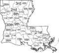
Louisiana judicial districts map.png 1,000 × 900; 181 KB
-
Maryland judicial circuit map.png 814 × 436; 43 KB
-
Massachusetts judicial district map.png 2,000 × 1,228; 358 KB
-
Michigan judicial circuit map.png 1,000 × 1,171; 194 KB
-
Minnesota judicial district map.png 734 × 816; 49 KB
-
Mississippi Chancery Courts districts.png 566 × 865; 51 KB
-
New York judicial districts.png 1,000 × 752; 78 KB
-
Ohio7thDistrictCourtAppealsMap.jpg 256 × 260; 55 KB
-
OHjudicialdistrictsmap.png 1,000 × 1,087; 139 KB
-
SCjudicialcircuits.png 815 × 647; 53 KB
-
Tennessee judicial districts map.png 918 × 288; 209 KB
-
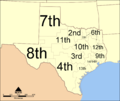
TXcoadistricts.png 2,000 × 1,682; 471 KB
-
United States Western District of New York counties.gif 866 × 696; 86 KB
-
WVjudicialcircuits.png 1,743 × 1,524; 87 KB


