Category:Maps of islands of Luzon
Jump to navigation
Jump to search
Media in category "Maps of islands of Luzon"
The following 10 files are in this category, out of 10 total.
-
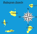
Babuyan-Islands.PNG 307 × 285; 27 KB
-
Babuyan islands en.png 1,205 × 731; 346 KB
-
Map of Corregidor 1941.jpg 2,066 × 1,241; 368 KB
-
Recapture of Corregidor 1945.jpg 2,056 × 1,456; 650 KB
-
Ph locator map luzon.png 300 × 440; 20 KB
-
Luzon Strait n7184.jpg 542 × 1,020; 77 KB
-
Luzon-strait0010.jpg 800 × 637; 243 KB
-
Ph locator map mindoro.png 300 × 440; 23 KB
-
Ph locator romblon sibuyan.png 300 × 300; 7 KB
-
TribalPhilippinesTraditionalRange.png 2,000 × 3,120; 208 KB


