Category:Maps of historic districts on the National Register of Historic Places in New York (state)
Jump to navigation
Jump to search
States of the United States: Alaska · Arkansas · Connecticut · Georgia · Idaho · Illinois · Indiana · Iowa · Louisiana · Maryland · Massachusetts · Michigan · Mississippi · Nebraska · New Jersey · New York · North Carolina · Ohio · Oregon · Pennsylvania · Rhode Island · Texas · Virginia · Washington · West Virginia · Wyoming
Puerto Rico
Puerto Rico
English: Maps showing the boundaries of historic districts listed on the National Register of Historic Places in New York
Español: Mapas de los distritos históricos en el Registro Nacional de Lugares Históricos en Nueva York
Subcategories
This category has the following 2 subcategories, out of 2 total.
Media in category "Maps of historic districts on the National Register of Historic Places in New York (state)"
The following 21 files are in this category, out of 21 total.
-
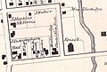
 154-155BriarcliffManor3.jpg 723 × 580; 102 KB
-
 1777BurgoyneTiconderoga.jpg 1,382 × 2,602; 1.22 MB
-
 1867 Beers North Castle map Armonk closeup.jpg 516 × 349; 205 KB
-
 Allentown Historic District map 2012.png 982 × 786; 409 KB
-
 Bedford Road Historic District map.svg 749 × 361; 64 KB
-
 Boston Post Road Historic District - East Stream and West Creek.jpg 1,024 × 602; 231 KB
-
 Central Troy Historic District map.png 268 × 411; 108 KB
-
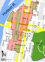
 Delaware Avenue Historic District.png 1,238 × 872; 589 KB
-
 Downtown Cohoes Historic District map.png 339 × 499; 91 KB
-
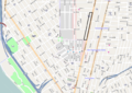
 Downtown Ossining Historic District map.png 677 × 818; 185 KB
-
 Gramercy Park Historic District.jpg 534 × 505; 38 KB
-
 Indian Brook Road Historic District map.png 179 × 188; 20 KB
-
 Jay Estate map.jpg 2,632 × 1,436; 925 KB
-
 Main Street-Albertson Street-Park Place Historic District Map.png 444 × 330; 29 KB
-
 Map of central Troy historic district 2.svg 297 × 406; 310 KB
-
 Map of central Troy historic district.svg 297 × 406; 68 KB
-
 Map of Montgomery showing historic districts.gif 422 × 359; 20 KB
-
 Map of the Scarborough Historic District.tiff 5,099 × 4,757; 92.53 MB
-
 Mill Street-North Clover Street Historic District map.png 724 × 481; 76 KB
-
 Union Street Historic District map, Poughkeepsie, NY.png 653 × 443; 81 KB
-
 Village of Monroe Historic District map.png 350 × 341; 78 KB


