Category:Maps of groups of communes in Yonne to 2015
Jump to navigation
Jump to search
Media in category "Maps of groups of communes in Yonne to 2015"
The following 41 files are in this category, out of 41 total.
-
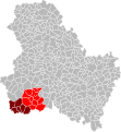
 Localisation EPCI Cœur de Puisaye dans l'Yonne, France.svg 1,000 × 1,085; 137 KB
-
 Localisation EPCI d'Othe-en-Armançon dans l'Yonne, France.svg 1,000 × 1,085; 137 KB
-
 Localisation EPCI de Forterre - Val d'Yonne dans l'Yonne, France.svg 1,000 × 1,085; 137 KB
-
 Localisation EPCI de Forterre dans l'Yonne, France.svg 1,000 × 1,085; 137 KB
-
 Localisation EPCI de l'Agglomération migennoise dans l'Yonne, France.svg 1,000 × 1,085; 137 KB
-
 Localisation EPCI de l'Aillantais dans l'Yonne, France.svg 1,000 × 1,085; 137 KB
-
 Localisation EPCI de l'Auxerrois dans l'Yonne, France.svg 1,000 × 1,085; 137 KB
-
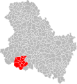
 Localisation EPCI de l'Avallonnais dans l'Yonne, France.svg 1,000 × 1,085; 137 KB
-

-
 Localisation EPCI de l'orée de Puisaye dans l'Yonne, France.svg 1,000 × 1,085; 190 KB
-
 Localisation EPCI de la haute vallée du Serein dans l'Yonne, France.svg 1,000 × 1,085; 137 KB
-

-
 Localisation EPCI de la Puisaye fargeaulaise dans l'Yonne, France.svg 1,000 × 1,085; 136 KB
-
 Localisation EPCI de la Région de Charny dans l'Yonne, France.svg 1,000 × 1,085; 137 KB
-
 Localisation EPCI de la Terre Plaine dans l'Yonne, France.svg 1,000 × 1,085; 137 KB
-
 Localisation EPCI de la Vallée du Serein dans l'Yonne, France.svg 1,000 × 1,085; 137 KB
-
 Localisation EPCI de la Vanne et du Pays d'Othe dans l'Yonne, France.svg 1,000 × 1,085; 137 KB
-
 Localisation EPCI de Saint-Sauveur-en-Puisaye dans l'Yonne, France.svg 1,000 × 1,085; 137 KB
-
 Localisation EPCI des Coteaux de la Chanteraine dans l'Yonne, France.svg 1,000 × 1,085; 136 KB
-
 Localisation EPCI du Canton d'Ancy-le-Franc dans l'Yonne, France.svg 1,000 × 1,085; 137 KB
-
 Localisation EPCI du Canton de Bléneau dans l'Yonne, France.svg 1,000 × 1,085; 137 KB
-
 Localisation EPCI du Chablisien dans l'Yonne, France.svg 1,000 × 1,085; 137 KB
-
 Localisation EPCI du Florentinois (2005) dans l'Yonne, France.svg 1,000 × 1,085; 137 KB
-
 Localisation EPCI du Florentinois dans l'Yonne, France.svg 1,000 × 1,085; 137 KB
-
 Localisation EPCI du Gâtinais en Bourgogne dans l'Yonne, France.svg 1,000 × 1,085; 137 KB
-
 Localisation EPCI du Jovinien dans l'Yonne, France.svg 1,000 × 1,085; 137 KB
-
 Localisation EPCI du Pays chablisien dans l'Yonne, France.svg 1,000 × 1,085; 190 KB
-
 Localisation EPCI du Pays coulangeois dans l'Yonne, France.svg 1,000 × 1,085; 137 KB
-
 Localisation EPCI du Pays de Coulanges-sur-Yonne dans l'Yonne, France.svg 1,000 × 1,085; 137 KB
-
 Localisation EPCI du Seignelois dans l'Yonne, France.svg 1,000 × 1,085; 137 KB
-
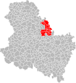
 Localisation EPCI du Sénonais dans l'Yonne, France.svg 1,000 × 1,085; 145 KB
-
 Localisation EPCI du Tonnerrois dans l'Yonne, France.svg 1,000 × 1,085; 137 KB
-
 Localisation EPCI du Toucycois dans l'Yonne, France.svg 1,000 × 1,085; 137 KB
-
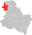
 Localisation EPCI du Villeneuvien dans l'Yonne, France.svg 1,000 × 1,085; 189 KB
-
 Localisation EPCI du Vézelien dans l'Yonne, France.svg 1,000 × 1,085; 137 KB
-
 Localisation EPCI entre Cure et Yonne dans l'Yonne, France.svg 1,000 × 1,085; 137 KB
-
 Localisation EPCI Le Tonnerrois en Bourgogne dans l'Yonne, France.svg 1,000 × 1,085; 191 KB
-
 Localisation EPCI Morvan-Vauban dans l'Yonne, France.svg 1,000 × 1,085; 137 KB
-
 Localisation EPCI Nucerienne dans l'Yonne, France.svg 1,000 × 1,085; 137 KB
-
 Localisation EPCI Portes de Puisaye Forterre dans l'Yonne, France.svg 1,000 × 1,085; 141 KB
-
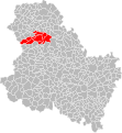
 Localisation EPCI Yonne Nord dans l'Yonne, France.svg 1,000 × 1,085; 137 KB


_dans_l%27Yonne,_France.svg)


