Category:Maps of groups of communes in Vosges to 2015
Jump to navigation
Jump to search
Media in category "Maps of groups of communes in Vosges to 2015"
The following 37 files are in this category, out of 37 total.
-
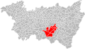
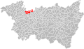
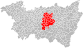 Localisation EPCI d'Épinal dans les Vosges, France.svg 1,000 × 582; 191 KB
-

-
-
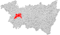
 Localisation EPCI de la Fave dans les Vosges, France.svg 1,000 × 582; 190 KB
-
 Localisation EPCI de la haute Meurthe dans les Vosges, France.svg 1,000 × 582; 190 KB
-
 Localisation EPCI de la haute Moselotte dans les Vosges, France.svg 1,000 × 582; 190 KB
-
 Localisation EPCI de la moyenne Moselle dans les Vosges, France.svg 1,000 × 582; 191 KB
-
 Localisation EPCI de la porte des hautes Vosges dans les Vosges, France.svg 1,000 × 582; 190 KB
-
 Localisation EPCI de la région de Rambervillers dans les Vosges, France.svg 1,000 × 582; 190 KB
-
 Localisation EPCI de la vallée de la Cleurie dans les Vosges, France.svg 1,000 × 582; 190 KB
-
 Localisation EPCI de la vallée de la Plaine dans les Vosges, France.svg 1,001 × 586; 167 KB
-
 Localisation EPCI de la vallée de la Vologne dans les Vosges, France.svg 1,000 × 582; 190 KB
-
 Localisation EPCI de la vallée du Hure dans les Vosges, France.svg 1,000 × 582; 190 KB
-
-
 Localisation EPCI de Vittel - Contrexéville dans les Vosges, France.svg 1,000 × 582; 190 KB
-
 Localisation EPCI des ballons des hautes Vosges dans les Vosges, France.svg 1,000 × 582; 190 KB
-
 Localisation EPCI des hauts champs dans les Vosges, France.svg 1,000 × 582; 190 KB
-
 Localisation EPCI des lacs et des hauts rupts dans les Vosges, France.svg 1,000 × 582; 190 KB
-
 Localisation EPCI des marches de Lorraine dans les Vosges, France.svg 1,000 × 582; 190 KB
-
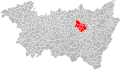
 Localisation EPCI des monts de Vologne dans les Vosges, France.svg 1,000 × 582; 190 KB
-
 Localisation EPCI des vallons du Bouchot et du Rupt dans les Vosges, France.svg 1,000 × 582; 190 KB
-
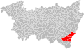
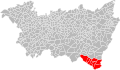
 Localisation EPCI des Vosges méridionales dans les Vosges, France.svg 1,000 × 582; 190 KB
-
 Localisation EPCI du ban d'Étival dans les Vosges, France.svg 1,000 × 582; 190 KB
-
 Localisation EPCI du bassin de Neufchâteau dans les Vosges, France.svg 1,000 × 582; 192 KB
-
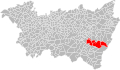
 Localisation EPCI du canton de Brouvelieures dans les Vosges, France.svg 1,000 × 582; 190 KB
-
 Localisation EPCI du pays de Châtenois dans les Vosges, France.svg 1,000 × 582; 191 KB
-
 Localisation EPCI du pays de la Saône vosgienne dans les Vosges, France.svg 1,000 × 582; 190 KB
-
 Localisation EPCI du pays de Mirecourt dans les Vosges, France.svg 1,000 × 582; 190 KB
-
 Localisation EPCI du pays de Saône et Madon dans les Vosges, France.svg 1,000 × 582; 190 KB
-
 Localisation EPCI du pays de Senones dans les Vosges, France.svg 1,000 × 582; 190 KB
-
 Localisation EPCI du secteur de Dompaire dans les Vosges, France.svg 1,000 × 582; 191 KB
-
 Localisation EPCI du val de Galilée dans les Vosges, France.svg 1,000 × 582; 190 KB
-
 Localisation EPCI du val de Meurthe dans les Vosges, France.svg 1,000 × 582; 190 KB
-
 Localisation EPCI du val de Neuné dans les Vosges, France.svg 1,000 × 582; 190 KB
-
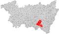
 Localisation EPCI du val de Vôge dans les Vosges, France.svg 1,000 × 582; 190 KB
-
 Localisation EPCI du Xaintois dans les Vosges, France.svg 1,000 × 582; 190 KB
-
 Localisation EPCI Fave et Meurthe dans les Vosges, France.svg 1,000 × 582; 190 KB


_dans_les_Vosges,_France.svg)


