Category:Maps of groups of communes in Isère to 2015
Jump to navigation
Jump to search
Media in category "Maps of groups of communes in Isère to 2015"
The following 39 files are in this category, out of 39 total.
-
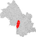
 Localisation EPCI Bièvre Chambaran dans l'Isère, France.svg 1,000 × 1,043; 201 KB
-
 Localisation EPCI Bièvre Isère dans l'Isère, France.svg 1,000 × 1,043; 201 KB
-
 Localisation EPCI Bourbre - Tisserands dans l'Isère, France.svg 1,000 × 1,043; 201 KB
-
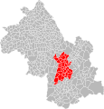
 Localisation EPCI Chambaran Vinay Vercors dans l'Isère, France.svg 1,000 × 1,043; 201 KB
-
 Localisation EPCI Chartreuse Guiers dans l'Isère, France.svg 1,000 × 1,043; 201 KB
-
 Localisation EPCI Cœur de Chartreuse dans l'Isère, France.svg 1,000 × 1,043; 205 KB
-
 Localisation EPCI de Bièvre est dans l'Isère, France.svg 1,000 × 1,043; 201 KB
-
 Localisation EPCI de l'isle Crémieu dans l'Isère, France.svg 1,000 × 1,043; 201 KB
-
 Localisation EPCI de l'Oisans dans l'Isère, France.svg 1,000 × 1,043; 201 KB
-
 Localisation EPCI de la Bourne à l'Isère dans l'Isère, France.svg 1,000 × 1,043; 201 KB
-
 Localisation EPCI de la chaîne des Tisserands dans l'Isère, France.svg 1,000 × 1,043; 200 KB
-
 Localisation EPCI de la Matheysine dans l'Isère, France.svg 1,000 × 1,043; 201 KB
-

-
 Localisation EPCI de la région saint-jeannaise dans l'Isère, France.svg 1,000 × 1,043; 201 KB
-
 Localisation EPCI de la vallée de l'Hien dans l'Isère, France.svg 1,000 × 1,043; 200 KB
-
 Localisation EPCI de Virieu - Vallée de la Bourbre dans l'Isère, France.svg 1,000 × 1,043; 200 KB
-
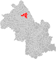
 Localisation EPCI des Balmes dauphinoises dans l'Isère, France.svg 1,000 × 1,043; 200 KB
-
 Localisation EPCI des collines du nord Dauphiné dans l'Isère, France.svg 1,000 × 1,043; 201 KB
-
 Localisation EPCI des vallons du Guiers dans l'Isère, France.svg 1,000 × 1,043; 200 KB
-
 Localisation EPCI du balcon sud de la Chartreuse dans l'Isère, France.svg 1,000 × 1,043; 200 KB
-
 Localisation EPCI du massif du Vercors dans l'Isère, France.svg 1,000 × 1,043; 200 KB
-
 Localisation EPCI du pays de Bièvre Liers dans l'Isère, France.svg 1,000 × 1,043; 201 KB
-
 Localisation EPCI du pays de Corps dans l'Isère, France.svg 1,000 × 1,043; 201 KB
-
 Localisation EPCI du pays de Saint-Marcellin dans l'Isère, France.svg 1,000 × 1,043; 201 KB
-
 Localisation EPCI du pays des couleurs dans l'Isère, France.svg 1,000 × 1,043; 201 KB
-
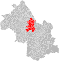
 Localisation EPCI du pays du Grésivaudan dans l'Isère, France.svg 1,000 × 1,043; 202 KB
-
 Localisation EPCI du pays roussillonnais dans l'Isère, France.svg 1,000 × 1,043; 201 KB
-
 Localisation EPCI du pays voironnais dans l'Isère, France.svg 1,000 × 1,043; 201 KB
-
 Localisation EPCI du sud Grenoblois dans l'Isère, France.svg 1,000 × 1,043; 201 KB
-
 Localisation EPCI du territoire de Beaurepaire dans l'Isère, France.svg 1,000 × 1,043; 201 KB
-
 Localisation EPCI du Trièves dans l'Isère, France.svg 1,000 × 1,043; 201 KB
-
 Localisation EPCI du Valbonnais dans l'Isère, France.svg 1,000 × 1,043; 201 KB
-
 Localisation EPCI Entre Bièvre et Rhône dans l'Isère, France.svg 1,000 × 1,043; 210 KB
-
 Localisation EPCI Grenoble Alpes Métropole dans l'Isère, France.svg 1,000 × 1,043; 202 KB
-
 Localisation EPCI Porte dauphinoise de Lyon Saint-Exupéry dans l'Isère, France.svg 1,000 × 1,043; 200 KB
-
 Localisation EPCI Porte de l'Isère dans l'Isère, France 2015.svg 1,000 × 1,043; 201 KB
-
 Localisation EPCI Porte de l'Isère dans l'Isère, France.svg 1,000 × 1,043; 201 KB
-
 Localisation EPCI Vallons de la Tour dans l'Isère, France.svg 1,000 × 1,043; 201 KB
-
 Localisation EPCI Vienne Agglomération dans l'Isère, France.svg 1,000 × 1,043; 201 KB


