Category:Maps of groups of communes in Haute-Marne to 2018
Jump to navigation
Jump to search
Media in category "Maps of groups of communes in Haute-Marne to 2018"
The following 11 files are in this category, out of 11 total.
-
 Gemeindeverband Auberive, Vingeanne et Montsaugeonnais 2018.png 3,499 × 2,580; 2.72 MB
-
 Gemeindeverband Bassin de Joinville en Champagne 2018.png 3,499 × 2,580; 2.72 MB
-
 Gemeindeverband Chaumont, Bassin Nogentais et Bassin de Bologne Vignory Froncles 2018.png 3,499 × 2,580; 2.73 MB
-
 Gemeindeverbände im Département Haute-Marne 2018.png 3,499 × 2,580; 2.75 MB
-
 Gemeindeverband Grand Langres 2018.png 3,499 × 2,580; 2.72 MB
-
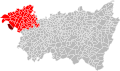 Localisation CC de l'Ouest Vosgien dans les Vosges, France.svg 973 × 576; 359 KB
-
 Gemeindeverband Meuse Rognon 2018.png 3,499 × 2,580; 2.73 MB
-
 Gemeindeverband Ouest Vosgien 2018.png 3,499 × 2,580; 2.76 MB
-

-
 Gemeindeverband Saint-Dizier, Der et Blaise 2018.png 3,499 × 2,580; 2.8 MB
-
 Gemeindeverband Trois Forêts 2018.png 3,499 × 2,580; 2.72 MB


