Category:Maps of groups of communes in Dordogne to 2015
Jump to navigation
Jump to search
Media in category "Maps of groups of communes in Dordogne to 2015"
The following 59 files are in this category, out of 59 total.
-
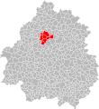
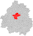
 Localisation EPCI astérienne dans la Dordogne, France.svg 1,000 × 1,088; 237 KB
-
 Localisation EPCI bergeracoise dans la Dordogne, France.svg 1,000 × 1,088; 238 KB
-
 Localisation EPCI Causse et Vézère dans la Dordogne, France.svg 1,000 × 1,088; 237 KB
-
 Localisation EPCI Causses et rivières en Périgord dans la Dordogne, France.svg 1,000 × 1,088; 238 KB
-
 Localisation EPCI de Domme - Villefranche-du-Périgord dans la Dordogne, France.svg 1,000 × 1,088; 238 KB
-
 Localisation EPCI de la basse vallée de l'Isle dans la Dordogne, France.svg 1,000 × 1,088; 237 KB
-
 Localisation EPCI de la moyenne vallée de l'Isle dans la Dordogne, France.svg 1,000 × 1,088; 237 KB
-
 Localisation EPCI de la vallée de l'Homme dans la Dordogne, France.svg 1,000 × 1,088; 238 KB
-
 Localisation EPCI de la vallée de la Dordogne dans la Dordogne, France.svg 1,000 × 1,088; 237 KB
-
 Localisation EPCI de la vallée de la Vézère dans la Dordogne, France.svg 1,000 × 1,088; 237 KB
-
 Localisation EPCI de la vallée du Salembre dans la Dordogne, France.svg 1,000 × 1,088; 237 KB
-
 Localisation EPCI de val et coteaux d'Eymet dans la Dordogne, France.svg 1,000 × 1,088; 237 KB
-
 Localisation EPCI des bastides Dordogne-Périgord dans la Dordogne, France.svg 1,000 × 1,088; 239 KB
-
 Localisation EPCI des coteaux de Sigoulès dans la Dordogne, France.svg 1,000 × 1,088; 237 KB
-
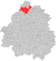
 Localisation EPCI des hauts de Dronne dans la Dordogne, France.svg 1,000 × 1,088; 237 KB
-
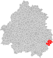
 Localisation EPCI des portes sud Périgord dans la Dordogne, France.svg 1,000 × 1,088; 238 KB
-
 Localisation EPCI des villages du haut Périgord dans la Dordogne, France.svg 1,000 × 1,088; 237 KB
-
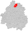
 Localisation EPCI Dronne et Belle dans la Dordogne, France.svg 1,000 × 1,088; 238 KB
-
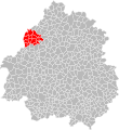
 Localisation EPCI du Brantômois dans la Dordogne, France.svg 1,000 × 1,088; 237 KB
-
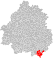
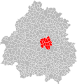
 Localisation EPCI du canton de Domme dans la Dordogne, France.svg 1,000 × 1,088; 238 KB
-
 Localisation EPCI du Carluxais terre de Fénelon dans la Dordogne, France.svg 1,000 × 1,088; 237 KB
-
 Localisation EPCI du haut Périgord dans la Dordogne, France.svg 1,000 × 1,088; 237 KB
-
 Localisation EPCI du Mussidanais en Périgord dans la Dordogne, France.svg 1,000 × 1,088; 237 KB
-
 Localisation EPCI du pays d'Hautefort dans la Dordogne, France.svg 1,000 × 1,088; 238 KB
-
 Localisation EPCI du pays de Champagnac en Périgord dans la Dordogne, France.svg 1,000 × 1,088; 237 KB
-
 Localisation EPCI du pays de Fénelon (2014) dans la Dordogne, France.svg 1,000 × 1,088; 238 KB
-
 Localisation EPCI du pays de Jumilhac-le-Grand dans la Dordogne, France.svg 1,000 × 1,088; 237 KB
-
 Localisation EPCI du pays de Lanouaille dans la Dordogne, France.svg 1,000 × 1,088; 237 KB
-
 Localisation EPCI du pays de Mareuil en Périgord dans la Dordogne, France.svg 1,000 × 1,088; 238 KB
-
 Localisation EPCI du pays de Saint-Aulaye dans la Dordogne, France.svg 1,000 × 1,088; 237 KB
-
 Localisation EPCI du pays de Villamblard dans la Dordogne, France.svg 1,000 × 1,088; 238 KB
-
 Localisation EPCI du pays du châtaignier dans la Dordogne, France.svg 1,000 × 1,088; 237 KB
-
 Localisation EPCI du pays issigeacois dans la Dordogne, France.svg 1,000 × 1,088; 238 KB
-
 Localisation EPCI du pays ribéracois dans la Dordogne, France.svg 1,000 × 1,088; 238 KB
-
 Localisation EPCI du pays thibérien dans la Dordogne, France.svg 1,000 × 1,088; 238 KB
-
 Localisation EPCI du pays vernois dans la Dordogne, France.svg 1,000 × 1,088; 238 KB
-

-
 Localisation EPCI du Périgord nontronnais dans la Dordogne, France.svg 1,000 × 1,088; 237 KB
-
 Localisation EPCI du Périgord vert dans la Dordogne, France.svg 1,000 × 1,088; 237 KB
-
 Localisation EPCI du Périgord vert granitique dans la Dordogne, France.svg 1,000 × 1,088; 237 KB
-
 Localisation EPCI du Périgord vert nontronnais dans la Dordogne, France.svg 1,000 × 1,088; 238 KB
-
 Localisation EPCI du Ribéracois dans la Dordogne, France.svg 1,000 × 1,088; 238 KB
-
 Localisation EPCI du Salignacois dans la Dordogne, France.svg 1,000 × 1,088; 237 KB
-
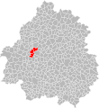
 Localisation EPCI du Terrassonais dans la Dordogne, France.svg 1,000 × 1,088; 238 KB
-

-
 Localisation EPCI du terroir de la truffe dans la Dordogne, France.svg 1,000 × 1,088; 237 KB
-
 Localisation EPCI du val de Dronne dans la Dordogne, France.svg 1,000 × 1,088; 237 KB
-
 Localisation EPCI du Verteillacois dans la Dordogne, France.svg 1,000 × 1,088; 238 KB
-
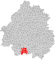
 Localisation EPCI entre Nauze et Bessède dans la Dordogne, France.svg 1,000 × 1,088; 238 KB
-
 Localisation EPCI Isle Double dans la Dordogne, France.svg 1,000 × 1,088; 237 KB
-
 Localisation EPCI Isle Double Landais dans la Dordogne, France.svg 1,000 × 1,088; 237 KB
-
 Localisation EPCI Isle Manoire en Périgord dans la Dordogne, France.svg 1,000 × 1,088; 238 KB
-
 Localisation EPCI Isle, Vern, Salembre en Périgord dans la Dordogne, France.svg 1,000 × 1,088; 238 KB
-
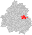
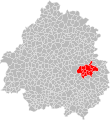
 Localisation EPCI Le Grand Périgueux dans la Dordogne, France.svg 1,000 × 1,088; 238 KB
-
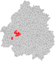
 Localisation EPCI Montaigne Montravel et Gurson dans la Dordogne, France.svg 1,000 × 1,088; 238 KB
-
 Localisation EPCI périgourdine dans la Dordogne, France.svg 1,000 × 1,088; 238 KB
-
 Localisation EPCI Sarlat Périgord noir dans la Dordogne, France.svg 1,000 × 1,088; 238 KB
-
 Localisation EPCI Terre de Cromagnon dans la Dordogne, France.svg 1,000 × 1,088; 238 KB
-
 Localisation EPCI Vallée de la Dordogne et forêt Bessède dans la Dordogne, France.svg 1,000 × 1,088; 238 KB


_dans_la_Dordogne,_France.svg)


