Category:Maps of geologic formations of the Marystown Group
Jump to navigation
Jump to search
Media in category "Maps of geologic formations of the Marystown Group"
The following 13 files are in this category, out of 13 total.
-
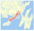
 Barasway Formation map.svg 512 × 458; 26.2 MB
-
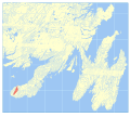
 Calmer Formation map.svg 512 × 458; 26.19 MB
-
 Cashel Lookout Formation map.svg 512 × 458; 27.32 MB
-
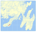
 Creston Formation map.svg 512 × 458; 26.23 MB
-
 Garnish Formation map.svg 512 × 458; 26.19 MB
-
 Grand Bank Sequence map.svg 512 × 458; 26.19 MB
-
 Harbour My God Point Formation map.svg 512 × 458; 26.2 MB
-
 Hare Hills Tuff map.svg 512 × 458; 26.18 MB
-
 Lamaline Basalts map.svg 512 × 458; 26.21 MB
-
 Mount Lucy Anne Formation map.svg 512 × 458; 26.22 MB
-
 Mount Saint Anne Formation map.svg 512 × 458; 26.2 MB
-
 Taylors Bay Formation map.svg 512 × 458; 26.3 MB
-
 Tilt Hills Formation map.svg 512 × 458; 26.2 MB


