Category:Maps of geologic formations of the Long Harbour Group
Jump to navigation
Jump to search
Media in category "Maps of geologic formations of the Long Harbour Group"
The following 7 files are in this category, out of 7 total.
-
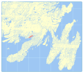
 Andersons Cove Formation map.svg 512 × 458; 26.43 MB
-
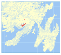
 Belle Bay Formation map.svg 512 × 458; 26.37 MB
-
 English Harbour East Formation map.svg 512 × 458; 26.24 MB
-
 Grand Le Pierre Formation map.svg 512 × 458; 26.22 MB
-
 Mooring Cove Formation map.svg 512 × 458; 26.29 MB
-
 Snooks Tolt Formation map.svg 512 × 458; 26.25 MB
-
 Southern Hills Formation map.svg 512 × 458; 26.4 MB


