Category:Maps of freguesias of Vila Real de Santo António
Jump to navigation
Jump to search
Media in category "Maps of freguesias of Vila Real de Santo António"
The following 11 files are in this category, out of 11 total.
-
 Monte Gordo (VRSA) localização.svg 2,122 × 1,600; 501 KB
-
 Vila Nova de Cacela (VRSA) localização.svg 2,122 × 1,600; 501 KB
-
 Vila Real de Santo António (VRSA) localização.svg 2,122 × 1,600; 501 KB
-
 Vila Real de Santo António freguesias.svg 2,122 × 1,600; 501 KB
-
 VRSA - Autárquicas 2005.JPG 580 × 458; 17 KB
-
 VRSA - Mapa.JPG 610 × 479; 22 KB
-
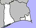
 VRSA-Monte Gordo.JPG 580 × 458; 17 KB
-
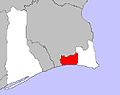
 VRSA-Vila Nova de Cacela.JPG 580 × 458; 17 KB
-
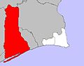
 VRSA-Vila Real de Santo António.JPG 580 × 458; 17 KB
-
 VRSA.JPG 580 × 458; 17 KB
-
 VRSAntonio 26.PNG 960 × 720; 92 KB
_localiza%C3%A7%C3%A3o.svg)
_localiza%C3%A7%C3%A3o.svg)
_localiza%C3%A7%C3%A3o.svg)


