Category:Maps of former subdivisions of Derbyshire
Jump to navigation
Jump to search
Media in category "Maps of former subdivisions of Derbyshire"
The following 18 files are in this category, out of 18 total.
-
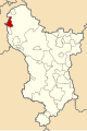
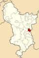 Alfreton Urban District, Derbyshire (1970).svg 449 × 670; 185 KB
-
 Ashbourne Rural District, Derbyshire (1970).svg 449 × 670; 185 KB
-
 Ashbourne Urban District, Derbyshire (1970).svg 449 × 670; 185 KB
-
 Bakewell Rural District, Derbyshire (1970).svg 449 × 670; 185 KB
-
 Bakewell Urban District, Derbyshire (1970).svg 449 × 670; 185 KB
-
 Belper Rural District, Derbyshire (1970).svg 449 × 670; 185 KB
-
 Belper Urban District, Derbyshire (1970).svg 449 × 670; 185 KB
-
 Blackwell Rural District, Derbyshire (1970).svg 449 × 670; 185 KB
-
 Bolsover Urban District, Derbyshire (1970).svg 449 × 670; 185 KB
-
 Chapel en le Frith Rural District, Derbyshire (1970).svg 449 × 670; 185 KB
-
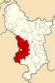
 Chesterfield Rural District, Derbyshire (1970).svg 449 × 670; 185 KB
-
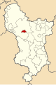
 Clay Cross Urban District, Derbyshire (1970).svg 449 × 670; 185 KB
-
 Clowne Rural District, Derbyshire (1970).svg 449 × 670; 185 KB
-
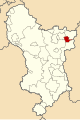
 Dronfield Urban District, Derbyshire (1970).svg 449 × 670; 185 KB
-
 Municipal Borough of Buxton, Derbyshire (1970).svg 449 × 670; 185 KB
-
 Municipal Borough of Chesterfield, Derbyshire (1970).svg 449 × 670; 185 KB
-
 Municipal Borough of Glossop, Derbyshire (1970).svg 449 × 670; 185 KB
-
 New Mills Urban District, Derbyshire (1970).svg 449 × 670; 185 KB
.svg)
.svg)
.svg)
.svg)
.svg)
.svg)
.svg)
.svg)
.svg)
.svg)
.svg)
.svg)
.svg)
.svg)
.svg)
.svg)
.svg)
.svg)