Category:Maps of former municipalities in Italy
Jump to navigation
Jump to search
Subcategories
This category has only the following subcategory.
M
Media in category "Maps of former municipalities in Italy"
The following 13 files are in this category, out of 13 total.
-
 Bevera in Alpes-Maritimes 1805.svg 1,234 × 1,110; 165 KB
-
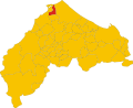
 Castel Colonna-Locatie.svg 1,052 × 744; 297 KB
-
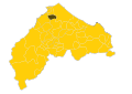
 Colbordolo-Locatie.svg 1,115 × 867; 111 KB
-
 Map of comune of Castel Colonna (province of Ancona, region Marche, Italy).svg 8,334 × 6,784; 88 KB
-
 Map of comune of Granaglione (province of Bologna, region Emilia-Romagna, Italy).svg 4,844 × 4,863; 131 KB
-
 Map of comune of Monterado (province of Ancona, region Marche, Italy).svg 8,334 × 6,784; 89 KB
-
 Map of comune of Porretta Terme (province of Bologna, region Emilia-Romagna, Italy).svg 4,844 × 4,863; 131 KB
-
 Map of comune of Ripe (province of Ancona, region Marche, Italy).svg 8,334 × 6,784; 89 KB
-
 Map of ex-comune of Felonica (province of Mantua, region Lombardy, Italy).svg 6,581 × 4,375; 126 KB
-
 Map of ex-comune of Sermide (province of Mantua, region Lombardy, Italy).svg 6,581 × 4,375; 126 KB
-
 Monterado-Locatie.svg 1,052 × 744; 297 KB
-
 Ripe-Locatie.svg 1,052 × 744; 297 KB
-
 Sant'Angelo in Lizzola-Locatie.svg 1,115 × 867; 110 KB


.svg)
.svg)
.svg)
.svg)
.svg)
.svg)
.svg)


