Category:Maps of floods in the United States
Jump to navigation
Jump to search
Countries of the Americas: Brazil · United States of America
Media in category "Maps of floods in the United States"
The following 18 files are in this category, out of 18 total.
-
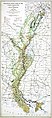 1927 LA Flood Map.jpg 2,292 × 5,214; 9.56 MB
-

-

-
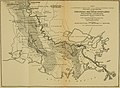 Bulletin of the U.S. Department of Agriculture (1913-1923.) (20474517256).jpg 3,474 × 2,550; 1.47 MB
-
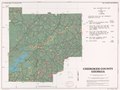 Cherokee County, Georgia - soil interpretive map of possibility for flooding LOC 82696083.tif 5,615 × 4,223; 67.84 MB
-
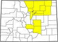 Colorado county map highlighting 14 counties affected by 2013 flooding.jpg 2,000 × 1,447; 536 KB
-

-
 Great Flood of 1993-Situation map-details-fr.svg 500 × 400; 505 KB
-
 Knox Mine Flood area from USMSHA report.gif 2,101 × 1,275; 229 KB
-
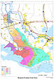
 Morganza Floodway Travel Times May 2011.jpg 1,650 × 2,549; 485 KB
-
 Morganza-spillway-times.jpg 1,024 × 1,582; 370 KB
-
 NO District Inundation Spring May 2011.jpg 5,000 × 3,263; 2.66 MB
-
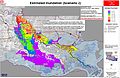
 NODInundationMay2011Scenario1a.jpg 2,550 × 1,651; 977 KB
-
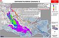
 NODInundationMay2011Scenario2.jpg 5,000 × 3,263; 2.55 MB
-
 NODInundationMay2011Scenario3.jpg 5,000 × 3,263; 2.52 MB
-
 Pennsylvania Lines West of Pittsburgh, Flood of March 1913 (51806780928).jpg 5,548 × 3,499; 14.46 MB
-
 Report on Hurricane Betsy USACE New Orleans 1965 Map of Inundated Areas.jpg 2,278 × 2,963; 2 MB
-


_(20474517256).jpg)

.jpg)


.jpg)

