Category:Maps of fictional countries on Earth
Appearance
Subcategories
This category has the following 8 subcategories, out of 8 total.
1
- Maps of Nineteen Eighty-Four (26 F)
A
G
- Maps of Gulliver's Travels (16 F)
J
- Jesusland map (9 F)
L
- Maps of Lemuria (11 F)
P
- Panem (6 F)
T
- Maps of Tintin (9 F)
Media in category "Maps of fictional countries on Earth"
The following 89 files are in this category, out of 89 total.
-
Allied States of America Jericho.PNG 1,427 × 628; 47 KB
-
American East Indies Flag Map.png 1,308 × 482; 53 KB
-
ARMA 2 Chernarus factbook map.png 620 × 515; 188 KB
-
ASA-USA Jericho Map.PNG 800 × 520; 54 KB
-
ASA-USA Jericho Map.svg 959 × 593; 148 KB
-
Basic shape of Listenbourg fictional country black.svg 1,055 × 1,107; 5 KB
-
Basic shape of Listenbourg fictional country.svg 1,055 × 1,107; 7 KB
-
Californie submergee simulation.svg 775 × 1,363; 485 KB
-
Canada flag map (without Quebec).svg 875 × 750; 25 KB
-
Carte Listenbourg.jpg 1,117 × 812; 105 KB
-
Chandragupta Maurya Empire.jpg 720 × 715; 379 KB
-
Das Neue Europa Mit Dem Dauernden Frieden. Die Unionisierung Mitteleuropas.jpg 8,578 × 6,229; 12.4 MB
-
Escape map.png 602 × 304; 10 KB
-
EU-Syldave.svg 1,070 × 900; 387 KB
-
Europe with and without Listenbourg fictional country grayscale.svg 961 × 1,400; 484 KB
-
Europe with and without Listenbourg fictional country.svg 2,087 × 1,166; 945 KB
-
Farneti Arabian Federation Attacco Occidente.svg 350 × 300; 106 KB
-
Farneti USA Nuovo Impero Occidente.svg 500 × 542; 45 KB
-
Fiat Lux Canticle map.png 850 × 607; 848 KB
-
Fictional Celtic State.svg 215 × 380; 87 KB
-
Fictional country from reversed map of France.svg 1,055 × 1,107; 83 KB
-
Fictional country Listenbourg color map.svg 1,720 × 1,248; 249 KB
-
Fictional country Listenbourg five regions and capital.svg 1,000 × 1,000; 46 KB
-
Fictional country Listenbourg map.svg 1,720 × 1,248; 249 KB
-
Flag map of the Mughal Empire.png 557 × 577; 88 KB
-
From France upside down to Listenbourg fictional country.svg 1,055 × 1,107; 502 KB
-
GermanyMustPerish2.jpg 1,890 × 1,300; 713 KB
-
GitS-Appleseed Imperial America 2030.png 950 × 650; 27 KB
-
GKR Map of Homefront.PNG 1,425 × 625; 54 KB
-
Groot-Nederland in Europa.PNG 1,025 × 673; 41 KB
-
Hall Another World and Yet the Same 1607 Cornell CUL PJM 1009 01.jpg 6,371 × 6,026; 4.83 MB
-
HOI4 State Map.png 5,632 × 2,048; 204 KB
-
Islandia Map.jpeg 419 × 343; 37 KB
-
Kaartflan.jpg 931 × 931; 130 KB
-
Kakinada Globe.jpg 2,784 × 2,815; 2.29 MB
-
Kingdom of Besmenia 1860 map.png 2,080 × 2,080; 1,020 KB
-
KINKOWII.JPG 280 × 186; 13 KB
-
Kraj Lovecrafta.svg 567 × 792; 1.1 MB
-
Location of Latveria.png 250 × 115; 2 KB
-
Latveria2.jpg 300 × 250; 15 KB
-
Latveria2.JPG 300 × 250; 22 KB
-
Le Pays Sauvage..svg 310 × 599; 246 KB
-
Locatie Symkaria.PNG 250 × 115; 4 KB
-
LocationUqbar (1917).png 250 × 115; 7 KB
-
Lovecraft country.jpg 1,885 × 1,089; 122 KB
-
Lovecraft Country.svg 567 × 792; 1.1 MB
-
Map from Mundus alter et idem.jpg 250 × 216; 22 KB
-
Map of a political game country.png 276 × 372; 19 KB
-
Map of Little Britain.png 387 × 600; 70 KB
-
Map of Sunda Empire.jpg 1,280 × 906; 209 KB
-
Map of the Atlantrop Projekt en.png 2,889 × 3,497; 4.65 MB
-
Map of the URTI.svg 400 × 336; 1.34 MB
-
Mapa de la República Federal d’Andalusia.svg 1,184 × 1,016; 450 KB
-
Mega-city One according to The Apocalypse War.svg 564 × 482; 102 KB
-
Mm4wwyc0dwy21.png 6,815 × 6,764; 12.39 MB
-
Mughal Empire (1700).png 1,120 × 750; 18 KB
-
Mughal Empire (orthographic projection).svg 541 × 541; 217 KB
-
MughalEmpire1700.svg 2,568 × 1,500; 147 KB
-
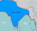
Mughals.gif 400 × 337; 10 KB
-
Mythical Kingdom of Quito english.jpg 2,776 × 3,608; 932 KB
-
New Byuzantia.png 1,200 × 1,000; 38 KB
-
No truce with Kings (map).svg 650 × 1,150; 354 KB
-
Palombia map.png 250 × 325; 6 KB
-
Palombia mapa.png 212 × 119; 3 KB
-
Partition of Switzerland.svg 600 × 660; 183 KB
-
Peking Government.png 1,280 × 1,280; 440 KB
-
People's Republic of Pineland.png 800 × 303; 73 KB
-
PMDA Location.png 633 × 714; 1.74 MB
-
Rhode Island in my worldkopie.gif 467 × 1,247; 47 KB
-
Schweiz Aufteilung nach Gaddafi Karte.png 650 × 701; 147 KB
-
Shalisuka Empire.jpg 720 × 677; 412 KB
-
Stefano Bonsignori - Kenya and Tanzania - Google Art Project.jpg 6,495 × 6,742; 16.22 MB
-
Sunset Song - Map including main characters.svg 940 × 480; 97 KB
-
Switzerland Gaddafi Map-English.png 650 × 701; 143 KB
-
The 62 provinces of a hypothetical Iberian State.svg 512 × 351; 512 KB
-
The Mughal Empire.jpg 2,225 × 2,185; 591 KB
-
The world in 2020 according to Tom Clancy.png 4,500 × 2,234; 453 KB
-
TNOflagMap.webp 4,096 × 1,491; 433 KB
-
United Slavic Republic.PNG 800 × 352; 56 KB
-
Vejsnoria location map.png 1,626 × 1,451; 390 KB
-
Wakanda in Africa.png 1,024 × 717; 43 KB
-
Wakanda map.svg 1,071 × 727; 640 KB
-
Xaojie map.png 1,280 × 1,280; 443 KB
-
Yemo plek in Atlantische Oceaan.png 390 × 356; 85 KB
-
Латверія і Симкарія.png 600 × 500; 65 KB
-
Легенда навчань "Запад-2017".jpg 660 × 400; 99 KB
-
Россматихат.png 640 × 400; 163 KB


