Category:Maps of ethnic groups in Asia
Jump to navigation
Jump to search
Subcategories
This category has the following 9 subcategories, out of 9 total.
Media in category "Maps of ethnic groups in Asia"
The following 71 files are in this category, out of 71 total.
-
0529121005168j0jg5b4jylwj5snftmefj.jpg 418 × 389; 22 KB
-
052912100531u4znhzkqf4qzc.jpg 561 × 730; 71 KB
-
LEROY-BEAULIEU(1893) p1.087 ETHNOGRAFICAL MAP OF NORTHERN ASIA.jpg 3,630 × 2,941; 5.78 MB
-
1992 Central Asia Ethnic Groups (30249738193).jpg 6,726 × 5,550; 22.5 MB
-
63 of 'China in Transformation ... With ... maps and diagrams' (11245961986).jpg 1,430 × 1,802; 698 KB
-
Anatolians.png 948 × 578; 497 KB
-
Bedouin map.jpg 483 × 746; 250 KB
-
Central Asia Ethnic en.svg 512 × 322; 762 KB
-
Central Asia Ethnic es.svg 2,392 × 1,504; 1.27 MB
-
Central Asia Ethnic mk.svg 2,392 × 1,504; 1.25 MB
-
Central Asia Ethnic.jpg 2,392 × 1,504; 678 KB
-
Chechen presence in Kurdistan.png 745 × 1,053; 216 KB
-
D087-Pl1b-Liv2-ch4.png 2,362 × 3,390; 1.5 MB
-
Distribution of Türkic people map.jpg 1,690 × 1,036; 545 KB
-
Ethnic Groups of Minahassa Peninsula - id.svg 512 × 265; 29 KB
-
Ethnic map of Asia Minor and Caucasus in 1914.jpg 1,270 × 795; 163 KB
-
Ethnic Map Of Cilicia Eng.jpg 1,134 × 728; 488 KB
-
Ethnic map of Ottoman Anatolia, Armenia, Syria (1917).jpg 3,289 × 2,035; 1.9 MB
-
Ethnic mosaic of Southeast Asia (2011).jpg 1,216 × 1,452; 480 KB
-
Ethnografická mapa Vysoké Asie.jpg 1,531 × 1,172; 591 KB
-
Indische Tamilen 2012.svg 652 × 709; 186 KB
-
Kalimantan Ethnic Groups.png 732 × 780; 81 KB
-
Kerngebiedvanpanturkisme.png 471 × 309; 11 KB
-
Map of ethnic Georgians significant distribution in Turkey.svg 550 × 325; 1.46 MB
-
Moors 2012.svg 652 × 709; 186 KB
-
Motors, people.png 916 × 778; 62 KB
-
Oman - Lengas.png 662 × 916; 69 KB
-
Peoples of the Philippines (1919) (14577373548).jpg 3,868 × 3,328; 858 KB
-
Percentage Tay+Nung+Giay+Bo Y.png 2,000 × 3,915; 791 KB
-
Persebaran Suku Melayu.png 2,640 × 2,185; 785 KB
-
Planche 5 - Ethnographie des mondes lointains - liv2-ch13.png 4,140 × 2,869; 2.35 MB
-
Samaria, Jordan-Israel border.gif 1,704 × 1,506; 109 KB
-
Singhalesen 2012.svg 652 × 709; 187 KB
-
Sri Lanka-Tamilen 2012.svg 652 × 709; 187 KB
-
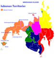
Subanon Territories.png 666 × 700; 126 KB
-
Pamir ethnological map-fr.svg 3,543 × 2,271; 3.31 MB
-
Tibetischer Kulturraum Karte 2.png 1,500 × 951; 454 KB
-
Turkstates Map.jpg 1,163 × 719; 231 KB
-
Verspreiding-Nenetsen.png 1,622 × 960; 68 KB
-
Yaghnobi regions.jpg 741 × 513; 40 KB
-
Zentralasien Ethnien.svg 2,392 × 1,504; 1.26 MB
-
Ėtnograficheskai︠a︡ karta Azīi︠a︡tskoĭ Rossīi LOC 99443161.tif 9,347 × 6,412; 171.47 MB
-
西晉時期北方各族分布圖.png 928 × 613; 45 KB


