Category:Maps of earthquakes in South Sandwich Islands region
Jump to navigation
Jump to search
Media in category "Maps of earthquakes in South Sandwich Islands region"
The following 36 files are in this category, out of 36 total.
-
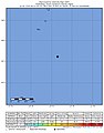
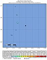
 2020-07-26 South Sandwich Islands region M6.3 earthquake shakemap (USGS).jpg 783 × 1,001; 129 KB
-

-
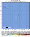
 2020-07-26 South Sandwich Islands region M6.4 earthquake shakemap (USGS).jpg 783 × 1,001; 132 KB
-

-
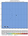
 2021-03-14 South Sandwich Islands region M6 earthquake shakemap (USGS).jpg 784 × 1,001; 132 KB
-
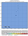
 2021-08-12 South Sandwich Islands region M6.1 earthquake shakemap (USGS).jpg 783 × 1,001; 130 KB
-

-

-

-
-

-

-
-
 2021-08-17 South Sandwich Islands region M6.1 earthquake shakemap (USGS).jpg 782 × 1,001; 132 KB
-

-
 2021-08-18 South Sandwich Islands region M6 earthquake shakemap (USGS).jpg 783 × 1,001; 128 KB
-

-

-

-

-

-

-

-
 2021-10-04 South Sandwich Islands region M6.3 earthquake shakemap (USGS).jpg 785 × 1,002; 151 KB
-
 2021-11-01 South Sandwich Islands region M6 earthquake shakemap (USGS).jpg 798 × 1,004; 134 KB
-
 2021-12-03 South Sandwich Islands region M6 earthquake shakemap (USGS).jpg 784 × 1,001; 133 KB
-
 2021-12-16 South Sandwich Islands region M6 earthquake shakemap (USGS).jpg 784 × 1,001; 134 KB
-
 2021-12-16 South Sandwich Islands region M6.1 earthquake shakemap (USGS).jpg 785 × 1,001; 137 KB
-

-
 2022-01-25 South Sandwich Islands region M6 earthquake shakemap (USGS).jpg 783 × 1,001; 135 KB
-

-
 2022-03-06 South Sandwich Islands region M6 earthquake shakemap (USGS).jpg 784 × 1,004; 84 KB
-

-
 2022-03-06 South Sandwich Islands region M6.1 earthquake shakemap (USGS).jpg 785 × 1,004; 82 KB
-

-
 2022-10-25 South Sandwich Islands region M6.3 earthquake shakemap (USGS).jpg 788 × 1,004; 84 KB
.jpg)
.jpg)
.jpg)
.jpg)
.jpg)
.jpg)
.jpg)
.jpg)
.jpg)
.jpg)
.jpg)
.jpg)
.jpg)
.jpg)
.jpg)
.jpg)
.jpg)
.jpg)
.jpg)
.jpg)
.jpg)
.jpg)
.jpg)
.jpg)
.jpg)
.jpg)
.jpg)
.jpg)
.jpg)
.jpg)
.jpg)
.jpg)
.jpg)
.jpg)
.jpg)
.jpg)