Category:Maps of districts of the Northern Cape
Jump to navigation
Jump to search
Media in category "Maps of districts of the Northern Cape"
The following 10 files are in this category, out of 10 total.
-
 Map of South Africa with Frances Baard highlighted (2016).svg 809 × 709; 736 KB
-
 Map of the Northern Cape with Frances Baard highlighted (2016).svg 750 × 764; 553 KB
-
 Map of South Africa with John Taolo Gaetsewe highlighted (2016).svg 809 × 709; 736 KB
-
 Map of the Northern Cape with John Taolo Gaetsewe highlighted (2016).svg 750 × 764; 552 KB
-
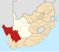 Map of South Africa with Namakwa highlighted (2016).svg 809 × 709; 773 KB
-
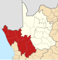 Map of the Northern Cape with Namakwa highlighted (2016).svg 750 × 764; 608 KB
-
 Map of South Africa with Pixley ka Seme highlighted (2016).svg 809 × 709; 755 KB
-
 Map of the Northern Cape with Pixley ka Seme highlighted (2016).svg 750 × 764; 579 KB
-
 Map of South Africa with ZF Mgcawu highlighted (2016).svg 809 × 709; 760 KB
-
 Map of the Northern Cape with ZF Mgcawu highlighted (2016).svg 750 × 764; 587 KB
.svg)
.svg)
.svg)
.svg)
.svg)
.svg)
.svg)
.svg)
.svg)
.svg)