Category:Maps of districts of the Free State
Jump to navigation
Jump to search
Media in category "Maps of districts of the Free State"
The following 10 files are in this category, out of 10 total.
-
 Map of South Africa with Fezile Dabi highlighted (2016).svg 809 × 709; 719 KB
-
 Map of the Free State with Fezile Dabi highlighted (2016).svg 828 × 693; 682 KB
-
 Map of South Africa with Lejweleputswa highlighted (2016).svg 809 × 709; 720 KB
-
 Map of the Free State with Lejweleputswa highlighted (2016).svg 828 × 693; 684 KB
-
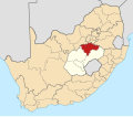
 Map of South Africa with Mangaung highlighted (2016).svg 809 × 709; 711 KB
-
 Map of the Free State with Mangaung highlighted (2016).svg 828 × 693; 659 KB
-
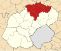
 Map of South Africa with Thabo Mofutsanyana highlighted (2016).svg 809 × 709; 724 KB
-
 Map of the Free State with Thabo Mofutsanyana highlighted (2016).svg 828 × 693; 698 KB
-
 Map of South Africa with Xhariep highlighted (2016).svg 809 × 709; 721 KB
-
 Map of the Free State with Xhariep highlighted (2016).svg 828 × 693; 691 KB
.svg)
.svg)
.svg)
.svg)
.svg)
.svg)
.svg)
.svg)
.svg)
.svg)