Category:Maps of districts of Sudan
Jump to navigation
Jump to search
Countries of Africa: Algeria · Botswana · Republic of the Congo · Ethiopia · Lesotho · Madagascar · Rwanda · South Africa · South Sudan · Sudan · Uganda · Zambia · Zimbabwe
Limited recognition: Somaliland
Limited recognition: Somaliland
Pages in category "Maps of districts of Sudan"
This category contains only the following page.
Media in category "Maps of districts of Sudan"
The following 113 files are in this category, out of 113 total.
-
 Blank map of Sudan administrative areas pre-2011.svg 600 × 704; 574 KB
-
 Sudan district map color.svg 725 × 688; 65 KB
-
 Sudan district map pre-2011.svg 744 × 1,052; 155 KB
-
 Sudan districts pre-2011.png 1,025 × 595; 17 KB
-
 Al Chartum district map overview.svg 744 × 1,052; 67 KB
-
 Al Dschazira district map overview.svg 744 × 1,052; 67 KB
-
 Al Qadarif Sudan district map overview.svg 744 × 1,052; 72 KB
-
 Al-Bahr al-ahmar district map overview.svg 744 × 1,052; 64 KB
-
 An-Nil al-abyad Sudan district map overview.svg 744 × 1,052; 70 KB
-
 An-Nil al-Azrag Sudan district map overview.svg 744 × 1,052; 46 KB
-
 Asch Schamaliyya district map overview.svg 744 × 1,052; 53 KB
-
 Blank map of North Sudan administrative areas.svg 600 × 520; 334 KB
-
 District of Abyei (Republic of Sudan).png 1,184 × 1,024; 206 KB
-
 Dschanub Darfur district map overview.svg 744 × 1,052; 83 KB
-
 Gharb Darfur district map overview.svg 744 × 1,052; 71 KB
-
 Kassala district map overview.svg 744 × 1,052; 68 KB
-
 Schamal Kurdufan Sudan district map overview.svg 744 × 1,052; 75 KB
-
 Nahr an-Nil district map overview.svg 744 × 1,052; 67 KB
-
 Nick-Krankheit Suedsudan.svg 1,000 × 762; 287 KB
-
 Sannar district map overview.svg 744 × 1,052; 70 KB
-
 Schamal Darfur zoom distrikt map.svg 744 × 1,052; 131 KB
-
 Sudan admin.svg 491 × 577; 174 KB
-
 Sudan district map Abu Hamad.svg 744 × 1,052; 155 KB
-
 Sudan district map Abu Jubaiyah.svg 744 × 1,052; 155 KB
-
 Sudan district map Abyei.svg 744 × 1,052; 155 KB
-
 Sudan district map Ad Damazin.svg 744 × 1,052; 155 KB
-
 Sudan district map Ad Damer.svg 744 × 1,052; 155 KB
-
 Sudan district map Ad Dinder.svg 744 × 1,052; 155 KB
-
 Sudan district map Ad Douiem.svg 744 × 1,052; 155 KB
-
 Sudan district map Adayala.svg 744 × 1,052; 155 KB
-
 Sudan district map Addabah.svg 744 × 1,052; 155 KB
-
 Sudan district map Al Deain.svg 744 × 1,052; 155 KB
-
 Sudan district map Al Fasher.svg 744 × 1,052; 155 KB
-
 Sudan district map Al Faw.svg 744 × 1,052; 155 KB
-
 Sudan district map Al Fushqa.svg 744 × 1,052; 155 KB
-
 Sudan district map Al Gadaref.svg 744 × 1,052; 155 KB
-
 Sudan district map Al Galabat.svg 744 × 1,052; 155 KB
-
 Sudan district map Al Gash.svg 744 × 1,052; 155 KB
-
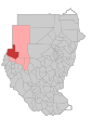
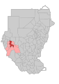
 Sudan district map Al Geneina.svg 744 × 1,052; 155 KB
-
 Sudan district map Al Gutaina.svg 744 × 1,052; 155 KB
-
 Sudan district map Al Hasaheisa.svg 744 × 1,052; 155 KB
-
 Sudan district map Al Jabalian.svg 744 × 1,052; 155 KB
-
 Sudan district map Al Kamlin.svg 744 × 1,052; 155 KB
-
 Sudan district map Al Kurumuk.svg 744 × 1,052; 155 KB
-
 Sudan district map Al Managil.svg 744 × 1,052; 155 KB
-
 Sudan district map Al Matammah.svg 744 × 1,052; 155 KB
-
 Sudan district map Al Rahd.svg 744 × 1,052; 155 KB
-
 Sudan district map Al Roseires.svg 744 × 1,052; 155 KB
-
 Sudan district map Aryat.svg 744 × 1,052; 155 KB
-
 Sudan district map As Salam.svg 744 × 1,052; 155 KB
-
 Sudan district map Atbara.svg 744 × 1,052; 155 KB
-
 Sudan district map Aweil.svg 744 × 1,052; 155 KB
-
 Sudan district map Bara.svg 744 × 1,052; 155 KB
-
 Sudan district map Barbar.svg 744 × 1,052; 155 KB
-
 Sudan district map Baw.svg 744 × 1,052; 155 KB
-
 Sudan district map Butana.svg 744 × 1,052; 155 KB
-
 Sudan district map Delling.svg 744 × 1,052; 155 KB
-
 Sudan district map Dongola.svg 744 × 1,052; 155 KB
-
 Sudan district map East Al Jazeera.svg 744 × 1,052; 155 KB
-
 Sudan district map Edd Al Fursan.svg 744 × 1,052; 155 KB
-
 Sudan district map En Nuhud.svg 744 × 1,052; 155 KB
-
 Sudan district map Geissan.svg 744 × 1,052; 155 KB
-
 Sudan district map Ghebeish.svg 744 × 1,052; 155 KB
-
 Sudan district map Habillah.svg 744 × 1,052; 155 KB
-
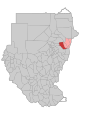
 Sudan district map Halayeb.svg 744 × 1,052; 155 KB
-
 Sudan district map Hamashkorieb.svg 744 × 1,052; 155 KB
-
 Sudan district map Jabal Aulia.svg 744 × 1,052; 155 KB
-
 Sudan district map Jebel Marra.svg 744 × 1,052; 155 KB
-
 Sudan district map Jebrat al Sheikh.svg 744 × 1,052; 155 KB
-
 Sudan district map Kabkabiya.svg 744 × 1,052; 155 KB
-
 Sudan district map Kadugli.svg 744 × 1,052; 155 KB
-
 Sudan district map Karary.svg 744 × 1,052; 155 KB
-
 Sudan district map Kas.svg 744 × 1,052; 155 KB
-
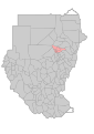
 Sudan district map Kassala.svg 744 × 1,052; 155 KB
-
 Sudan district map Khartoum Bahri.svg 744 × 1,052; 155 KB
-
 Sudan district map Khartoum.svg 744 × 1,052; 155 KB
-
 Sudan district map Kosti.svg 744 × 1,052; 155 KB
-
 Sudan district map Kulbus.svg 744 × 1,052; 155 KB
-
 Sudan district map Kutum.svg 744 × 1,052; 155 KB
-
 Sudan district map Lagawa.svg 744 × 1,052; 155 KB
-
 Sudan district map Mellit.svg 744 × 1,052; 155 KB
-
 Sudan district map Merawi.svg 744 × 1,052; 155 KB
-
 Sudan district map Mukjar.svg 744 × 1,052; 155 KB
-
 Sudan district map Nahr Atbara.svg 744 × 1,052; 155 KB
-
 Sudan district map North Al Jazeera.svg 744 × 1,052; 155 KB
-
 Sudan district map Nyala.svg 744 × 1,052; 155 KB
-
 Sudan district map Port Sudan.svg 744 × 1,052; 155 KB
-
 Sudan district map Rashad.svg 744 × 1,052; 155 KB
-
 Sudan district map Rehed Al Birdi.svg 744 × 1,052; 155 KB
-
 Sudan district map Sennar.svg 744 × 1,052; 155 KB
-
 Sudan district map Sharg En Nile.svg 744 × 1,052; 155 KB
-
 Sudan district map Shearia.svg 744 × 1,052; 155 KB
-
 Sudan district map Sheikan.svg 744 × 1,052; 155 KB
-
 Sudan district map Shendi.svg 744 × 1,052; 155 KB
-
 Sudan district map Singa.svg 744 × 1,052; 155 KB
-
 Sudan district map Sinkat.svg 744 × 1,052; 155 KB
-
 Sudan district map South Al Jazeera.svg 744 × 1,052; 155 KB
-
 Sudan district map Sowdari.svg 744 × 1,052; 155 KB
-
 Sudan district map Talodi.svg 744 × 1,052; 155 KB
-
 Sudan district map Tokar.svg 744 × 1,052; 155 KB
-
 Sudan district map Tulus.svg 744 × 1,052; 155 KB
-
 Sudan district map Um Al Gura.svg 744 × 1,052; 155 KB
-
 Sudan district map Um Badda.svg 744 × 1,052; 155 KB
-
 Sudan district map Um Durman.svg 744 × 1,052; 94 KB
-
 Sudan district map Um Kadada.svg 744 × 1,052; 155 KB
-
 Sudan district map Um Rawaba.svg 744 × 1,052; 155 KB
-
 Sudan district map Wadi Halfa.svg 744 × 1,052; 155 KB
-
 Sudan district map Wadi Salih.svg 744 × 1,052; 155 KB
-
 Sudan district map Zallingi.svg 744 × 1,052; 155 KB
-
 Sudan districts affected by nodding disease.svg 817 × 627; 19 KB
-
 Sudan districts(2011).png 545 × 439; 13 KB
-
 Sudan districts1.png 502 × 579; 14 KB
-
 Sudanese Districts affected by demarcation dispute with Ethiopia.svg 600 × 520; 334 KB


.png)


.png)

