
Category:Maps of districts of Mexico City
Subcategories
This category has the following 16 subcategories, out of 16 total.
A
- Maps of Azcapotzalco (5 F)
B
C
- Maps of Coyoacán (11 F)
I
- Maps of Iztacalco (4 F)
- Maps of Iztapalapa (13 F)
L
M
- Maps of Milpa Alta (8 F)
T
- Maps of Tláhuac (9 F)
- Maps of Tlalpan (7 F)
X
- Maps of Xochimilco (6 F)
Media in category "Maps of districts of Mexico City"
The following 7 files are in this category, out of 7 total.
-
 Blank map of Mexico DF.svg 440 × 553; 127 KB
-
 Boroughs of Mexican Federal District numbered.png 500 × 350; 14 KB
-
 Boroughs of Mexican Federal District numbered.svg 536 × 717; 30 KB
-
 Boroughs of Mexican Federal District.png 500 × 350; 9 KB
-
 CDMX Elección (blanco).png 561 × 717; 128 KB
-
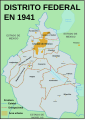 DFmex TERRITORIO 1941.svg 217 × 301; 213 KB
-
 MX-DF-División política.png 816 × 1,056; 87 KB


.png)

