Category:Maps of districts of Koblenz
Jump to navigation
Jump to search
Media in category "Maps of districts of Koblenz"
The following 30 files are in this category, out of 30 total.
-
 Karte von Neuendorf in Koblenz.svg 744 × 750; 79 KB
-
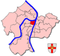 Stadtteilkarte Koblenz-Altstadt.png 650 × 606; 184 KB
-
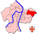 Stadtteilkarte Koblenz-Arenberg.png 650 × 606; 183 KB
-
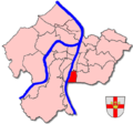
 Stadtteilkarte Koblenz-Arzheim.png 650 × 606; 183 KB
-
 Stadtteilkarte Koblenz-Asterstein.png 650 × 606; 184 KB
-
 Stadtteilkarte Koblenz-Bubenheim.png 650 × 606; 161 KB
-
 Stadtteilkarte Koblenz-Ehrenbreitstein.png 650 × 606; 184 KB
-
 Stadtteilkarte Koblenz-Goldgrube.png 650 × 606; 184 KB
-
 Stadtteilkarte Koblenz-Güls.png 650 × 606; 183 KB
-
 Stadtteilkarte Koblenz-Horchheim.png 650 × 606; 184 KB
-
 Stadtteilkarte Koblenz-Horchheimer Höhe.png 650 × 606; 183 KB
-
 Stadtteilkarte Koblenz-Immendorf.png 650 × 606; 184 KB
-
 Stadtteilkarte Koblenz-Karthause.png 650 × 606; 179 KB
-
 Stadtteilkarte Koblenz-Kesselheim.png 650 × 606; 161 KB
-
 Stadtteilkarte Koblenz-Lay.png 650 × 606; 237 KB
-
 Stadtteilkarte Koblenz-Lützel.png 650 × 606; 161 KB
-
 Stadtteilkarte Koblenz-Metternich.png 650 × 606; 160 KB
-
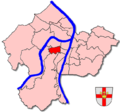
 Stadtteilkarte Koblenz-Mitte.png 650 × 606; 184 KB
-
 Stadtteilkarte Koblenz-Moselweiß.png 650 × 606; 183 KB
-
 Stadtteilkarte Koblenz-Neuendorf.png 650 × 606; 161 KB
-
 Stadtteilkarte Koblenz-Niederberg.png 650 × 606; 184 KB
-
 Stadtteilkarte Koblenz-Oberwerth.png 650 × 606; 184 KB
-
 Stadtteilkarte Koblenz-Pfaffendorf.png 650 × 606; 184 KB
-
 Stadtteilkarte Koblenz-Pfaffendorfer Höhe.png 650 × 606; 184 KB
-
 Stadtteilkarte Koblenz-Rauental.png 650 × 606; 184 KB
-
 Stadtteilkarte Koblenz-Rübenach.png 650 × 606; 182 KB
-
 Stadtteilkarte Koblenz-Stolzenfels.png 650 × 606; 183 KB
-
 Stadtteilkarte Koblenz-Süd.png 650 × 606; 184 KB
-
 Stadtteilkarte Koblenz-Südliche Vorstadt.png 650 × 606; 178 KB
-
 Stadtteilkarte Koblenz-Wallersheim.png 650 × 606; 161 KB


