Category:Maps of districts of Gilgit-Baltistan
Jump to navigation
Jump to search
Provinces of Pakistan: Khyber Pakhtunkhwa · Punjab · Sindh ·
Territories: Azad Kashmir · Gilgit-Baltistan ·
Territories: Azad Kashmir · Gilgit-Baltistan ·
Subcategories
This category has only the following subcategory.
Media in category "Maps of districts of Gilgit-Baltistan"
The following 11 files are in this category, out of 11 total.
-
 Gilgit-Baltistan map with tehsils labelled.png 8,058 × 4,022; 1.47 MB
-
 Gilgit-Baltistan Districts.svg 1,000 × 670; 24 KB
-
 Northern Districts of Pakistan.png 3,140 × 1,996; 303 KB
-
 Northern Areas Pakistan.svg 1,005 × 639; 140 KB
-
 उत्तरी क्षेत्र पाकिस्तान.png 2,000 × 1,272; 232 KB
-
 Gilgit-Baltistan Districts Names.svg 4,166 × 2,787; 392 KB
-
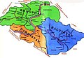 Dardistan Map.jpg 350 × 241; 21 KB
-
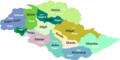
 Gilgit Baltistan Administrative divisions and districts.png 660 × 361; 43 KB
-
 Gilgit-Baltistan Map.jpg 600 × 309; 32 KB
-
 Map of ghizer.jpg 3,097 × 2,131; 625 KB
-
 Nagar Map.gif 700 × 600; 11 KB


