Category:Maps of districts of Gaziantep Province
Jump to navigation
Jump to search
Media in category "Maps of districts of Gaziantep Province"
The following 22 files are in this category, out of 22 total.
-
 Gaziantep districts.png 1,056 × 816; 28 KB
-
 Gaziantep location districts.png 1,011 × 700; 77 KB
-
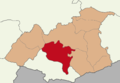
 Gaziantep.JPG 538 × 369; 27 KB
-
 Araban Gaziantep.png 300 × 220; 17 KB
-
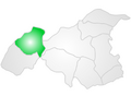
 Gaziantep location Araban.png 1,011 × 700; 50 KB
-
 Gaziantep location Karkamış.png 1,011 × 700; 50 KB
-
 Gaziantep location Nizip.png 1,011 × 700; 50 KB
-
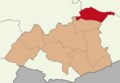
 Gaziantep location Nurdağı.png 1,011 × 700; 50 KB
-
 Gaziantep location Oğuzeli.png 1,011 × 700; 50 KB
-
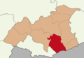
 Gaziantep location Yavuzeli.png 1,011 × 700; 50 KB
-
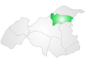
 Gaziantep location İslahiye.png 1,011 × 700; 50 KB
-
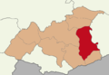
 Gaziantep location Şahinbey.png 1,011 × 700; 50 KB
-
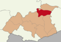
 Gaziantep location Şehitkamil.png 1,011 × 700; 51 KB
-
 Islahiye Gaziantep.png 300 × 220; 19 KB
-
 Karkamis Gaziantep.png 300 × 220; 17 KB
-
 Navçeyên Entabê.png 1,056 × 816; 42 KB
-
 Nizip Gaziantep.png 300 × 220; 19 KB
-
 Nurdagi Gaziantep.png 300 × 220; 19 KB
-
 Oguzeli Gaziantep.png 300 × 220; 18 KB
-
 Sahinbey Gaziantep.png 300 × 220; 19 KB
-
 Sehitkamil Gaziantep.png 300 × 220; 19 KB
-
 Yavuzeli Gaziantep.png 300 × 220; 18 KB


