Category:Maps of districts of Elâzığ Province
Jump to navigation
Jump to search
Media in category "Maps of districts of Elâzığ Province"
The following 15 files are in this category, out of 15 total.
-
 Elazığ districts.png 1,056 × 816; 23 KB
-
 Elazığ location districts.png 1,280 × 800; 86 KB
-
 Xeritaya wılayetê Xarpêti.png 1,056 × 816; 63 KB
-
 Elazığ location Alacakaya.png 1,280 × 800; 74 KB
-
 Elazığ location Arıcak.png 1,280 × 800; 74 KB
-
 Elazığ location Ağın.png 1,280 × 800; 74 KB
-
 Elazığ location Baskil.png 1,280 × 800; 74 KB
-
 Elazığ location Karakoçan.png 1,280 × 800; 74 KB
-
 Elazığ location Keban.png 1,280 × 800; 74 KB
-
 Elazığ location Kovancılar.png 1,280 × 800; 74 KB
-
 Elazığ location Maden.png 1,280 × 800; 74 KB
-
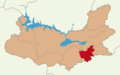
 Elazığ location Merkez.png 1,280 × 800; 74 KB
-
 Elazığ location Palu.png 1,280 × 800; 74 KB
-
 Elazığ location Sivrice.png 1,280 × 800; 74 KB
-
 Navçeyên Xarpêtê.png 776 × 600; 83 KB


