Category:Maps of districts of Besançon
Jump to navigation
Jump to search
Media in category "Maps of districts of Besançon"
The following 28 files are in this category, out of 28 total.
-
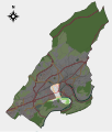
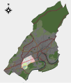
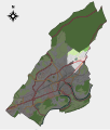
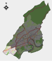
 Besancon map district 01.svg 701 × 823; 2.46 MB
-
 Besancon map district 02.svg 701 × 823; 2.46 MB
-
 Besancon map district 03.svg 701 × 823; 2.46 MB
-
 Besancon map district 04.svg 701 × 823; 2.46 MB
-
 Besancon map district 05.svg 701 × 823; 2.46 MB
-
 Besancon map district 06.svg 701 × 823; 2.46 MB
-
 Besancon map district 07.svg 701 × 823; 2.46 MB
-
 Besancon map district 08.svg 701 × 823; 2.46 MB
-
 Besancon map district 09.svg 701 × 823; 2.46 MB
-
 Besancon map district 10.svg 701 × 823; 2.46 MB
-
 Besancon map district 11.svg 701 × 823; 2.46 MB
-
 Besancon map district 12.svg 701 × 823; 2.46 MB
-
 Besancon map district 13.svg 701 × 823; 2.46 MB
-
 Besancon map district 14.svg 701 × 823; 2.46 MB
-
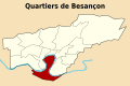
 Quartier de Besançon-Battant.svg 900 × 600; 37 KB
-
 Quartier de Besançon-Bregille.svg 900 × 600; 37 KB
-
 Quartier de Besançon-Butte Grette.svg 900 × 600; 37 KB
-
 Quartier de Besançon-Centre Chapelle des Buis.svg 900 × 600; 37 KB
-
 Quartier de Besançon-Chailluz.svg 900 × 600; 37 KB
-
 Quartier de Besançon-Chaprais Cras.svg 900 × 600; 37 KB
-
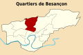 Quartier de Besançon-Montrapon Montboucons.svg 900 × 600; 37 KB
-
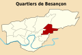 Quartier de Besançon-Palente Orchamps Saragosse.svg 900 × 600; 37 KB
-
 Quartier de Besançon-Planoise Châteaufarine.svg 900 × 600; 37 KB
-
 Quartier de Besançon-Saint-Claude Torcols.svg 900 × 600; 37 KB
-
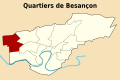
 Quartier de Besançon-Saint-Ferjeux Rosemont.svg 900 × 600; 37 KB
-
 Quartier de Besançon-Tilleroyes.svg 900 × 600; 37 KB
-
 Quartier de Besançon-Vaîte Clairs-Soleils.svg 900 × 600; 37 KB
-
 Quartier de Besançon-Velotte.svg 900 × 600; 37 KB


