Category:Maps of districts of Adana Province
Jump to navigation
Jump to search
Media in category "Maps of districts of Adana Province"
The following 24 files are in this category, out of 24 total.
-
 Adana (tr).svg 586 × 864; 38 KB
-
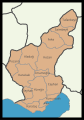
 Adana districts.png 1,056 × 816; 42 KB
-
 Adana districts.svg 629 × 903; 874 KB
-
 Adana ilceler.svg 339 × 484; 545 KB
-
 Adana location districts.svg 629 × 903; 281 KB
-
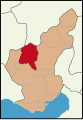 Adana location Aladağ.svg 629 × 903; 218 KB
-
 Adana location Ceyhan.svg 629 × 903; 218 KB
-
 Adana location Feke.svg 629 × 903; 218 KB
-
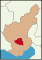
 Adana location Karaisali.svg 629 × 903; 218 KB
-
 Adana location Karataş.svg 629 × 903; 218 KB
-
 Adana location Kozan.svg 629 × 903; 218 KB
-
 Adana location Merkez.svg 629 × 903; 218 KB
-
 Adana location Pozantı.svg 629 × 903; 218 KB
-
 Adana location Saimbeyli.svg 629 × 903; 218 KB
-
 Adana location Sarıçam.svg 629 × 903; 218 KB
-
 Adana location Seyhan.svg 629 × 903; 218 KB
-
 Adana location Tufanbeyli.svg 629 × 903; 218 KB
-
 Adana location Yumurtalık.svg 629 × 903; 218 KB
-
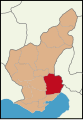
 Adana location Yüreğir.svg 629 × 903; 218 KB
-
 Adana location Çukurova.svg 629 × 903; 218 KB
-
 Adana location İmamoğlu.svg 629 × 903; 218 KB
-
 Location of Cukurova District.png 250 × 359; 24 KB
-
 Metropolitan Districts of Adana.png 417 × 599; 63 KB
-
 Çukurova map.png 417 × 599; 46 KB
.svg)


