Category:Maps of districts of Çankırı Province
Jump to navigation
Jump to search
Media in category "Maps of districts of Çankırı Province"
The following 15 files are in this category, out of 15 total.
-
 Çankırı (tr).svg 924 × 624; 31 KB
-
 Çankırı districts.png 1,056 × 816; 37 KB
-
 Çankırı location districts.png 1,200 × 800; 94 KB
-
 Çankırı location Atkaracalar.png 1,200 × 800; 58 KB
-
 Çankırı location Bayramören.png 1,200 × 800; 58 KB
-
 Çankırı location Eldivan.png 1,200 × 800; 59 KB
-
 Çankırı location Ilgaz.png 1,200 × 800; 58 KB
-
 Çankırı location Kızılırmak.png 1,200 × 800; 58 KB
-
 Çankırı location Korgun.png 1,200 × 800; 58 KB
-
 Çankırı location Kurşunlu.png 1,200 × 800; 59 KB
-
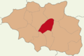
 Çankırı location Merkez.png 1,200 × 800; 59 KB
-
 Çankırı location Orta.png 1,200 × 800; 58 KB
-
 Çankırı location Yapraklı.png 1,200 × 800; 58 KB
-
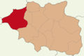 Çankırı location Çerkeş.png 1,200 × 800; 58 KB
-
 Çankırı location Şabanözü.png 1,200 × 800; 58 KB
.svg)


