Category:Maps of departments of Colombia by User:Milenioscuro
Jump to navigation
Jump to search
Media in category "Maps of departments of Colombia by User:Milenioscuro"
The following 99 files are in this category, out of 99 total.
-
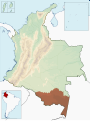
 Colombia - Amazonas.svg 2,027 × 2,294; 636 KB
-
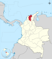
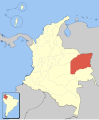
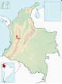
 Colombia - Antioquia.svg 2,027 × 2,294; 636 KB
-
 Colombia - Arauca.svg 2,027 × 2,294; 636 KB
-
 Colombia - Atlántico.svg 2,027 × 2,294; 636 KB
-
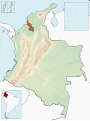
 Colombia - Bolívar.svg 2,027 × 2,294; 637 KB
-
 Colombia - Boyacá.svg 2,027 × 2,294; 636 KB
-
 Colombia - Caldas.svg 2,027 × 2,294; 636 KB
-
 Colombia - Caquetá.svg 2,027 × 2,294; 636 KB
-
 Colombia - Casanare.svg 2,027 × 2,294; 636 KB
-
 Colombia - Cesar.svg 2,027 × 2,294; 636 KB
-
 Colombia - Chocó.svg 2,027 × 2,294; 636 KB
-
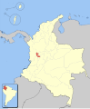
 Colombia - Cundinamarca.svg 2,027 × 2,294; 636 KB
-
 Colombia - Córdoba.svg 2,027 × 2,294; 636 KB
-
 Colombia - Distrito Capital.svg 2,027 × 2,294; 636 KB
-
 Colombia - Guainía.svg 2,027 × 2,294; 636 KB
-
 Colombia - Guaviare.svg 2,027 × 2,294; 636 KB
-
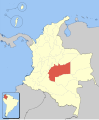
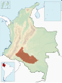
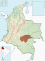
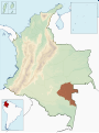
 Colombia - Huila.svg 2,027 × 2,294; 636 KB
-
 Colombia - La Guajira.svg 2,027 × 2,294; 636 KB
-
 Colombia - Magdalena.svg 2,027 × 2,294; 636 KB
-
 Colombia - Meta.svg 2,027 × 2,294; 636 KB
-
 Colombia - Nariño.svg 2,027 × 2,294; 636 KB
-
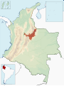
 Colombia - Norte de Santander.svg 2,027 × 2,294; 636 KB
-
 Colombia - Putumayo.svg 2,027 × 2,294; 636 KB
-
 Colombia - Quindío.svg 2,027 × 2,294; 636 KB
-
 Colombia - Risaralda.svg 2,027 × 2,294; 636 KB
-
 Colombia - San Andrés y Providencia.svg 2,027 × 2,294; 657 KB
-
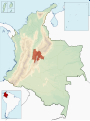
 Colombia - Santander.svg 2,027 × 2,294; 636 KB
-
 Colombia - Sucre.svg 2,027 × 2,294; 636 KB
-
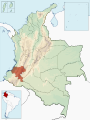
 Colombia - Tolima.svg 2,027 × 2,294; 597 KB
-
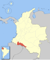
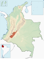
 Colombia - Valle del Cauca.svg 2,027 × 2,294; 649 KB
-
 Colombia - Vaupés.svg 2,027 × 2,294; 636 KB
-
 Colombia - Vichada.svg 2,027 × 2,294; 636 KB
-
 Colombia Amazonas loc map.svg 1,763 × 2,126; 476 KB
-
 Colombia Antioquia loc map.svg 1,763 × 2,126; 476 KB
-
 Colombia Arauca loc map.svg 1,763 × 2,126; 476 KB
-
 Colombia Atlantico loc map.svg 1,763 × 2,126; 476 KB
-
 Colombia Bolivar loc map.svg 1,763 × 2,126; 476 KB
-
 Colombia Boyaca loc map.svg 1,763 × 2,126; 476 KB
-
 Colombia Caldas loc map.svg 1,763 × 2,126; 476 KB
-
 Colombia Caqueta loc map.svg 1,763 × 2,126; 476 KB
-
 Colombia Casanare loc map.svg 1,763 × 2,126; 476 KB
-
 Colombia Cauca loc map.svg 1,763 × 2,126; 477 KB
-
 Colombia Cesar loc map.svg 1,763 × 2,126; 476 KB
-
 Colombia Choco loc map.svg 1,763 × 2,126; 476 KB
-
 Colombia Cordoba loc map.svg 1,763 × 2,126; 476 KB
-
 Colombia Cundinamarca loc map.svg 1,763 × 2,126; 476 KB
-
 Colombia Distrito Capital loc map.svg 1,763 × 2,126; 476 KB
-
 Colombia Guainia loc map.svg 1,763 × 2,126; 476 KB
-
 Colombia Guaviare loc map.svg 1,763 × 2,126; 476 KB
-
 Colombia Huila loc map.svg 1,763 × 2,126; 476 KB
-
 Colombia La Guajira loc map.svg 1,763 × 2,126; 476 KB
-
 Colombia Magdalena loc map.svg 1,763 × 2,126; 476 KB
-
 Colombia Meta loc map.svg 1,763 × 2,126; 476 KB
-
 Colombia Narino loc map.svg 1,763 × 2,126; 476 KB
-
 Colombia Norte de Santander loc map.svg 1,763 × 2,126; 476 KB
-
 Colombia Putumayo loc map.svg 1,763 × 2,126; 476 KB
-
 Colombia Quindio loc map.svg 1,763 × 2,126; 476 KB
-
 Colombia Risaralda loc map.svg 1,763 × 2,126; 476 KB
-
 Colombia San Andres y Providencia loc map.svg 1,763 × 2,126; 479 KB
-
 Colombia Santander loc map.svg 1,763 × 2,126; 476 KB
-
 Colombia Sucre loc map.svg 1,763 × 2,126; 476 KB
-
 Colombia Tolima loc map.svg 1,763 × 2,126; 476 KB
-
 Colombia Valle del Cauca loc map.svg 1,763 × 2,126; 477 KB
-
 Colombia Vaupes loc map.svg 1,763 × 2,126; 476 KB
-
 Colombia Vichada loc map.svg 1,763 × 2,126; 476 KB
-
 Colombia-deps-amazonas.svg 1,420 × 1,896; 875 KB
-
 Colombia-deps-antioquia.svg 1,420 × 1,896; 875 KB
-
 Colombia-deps-arauca.svg 1,420 × 1,896; 875 KB
-
 Colombia-deps-atlantico.svg 1,420 × 1,896; 875 KB
-
 Colombia-deps-bolivar.svg 1,420 × 1,896; 875 KB
-
 Colombia-deps-boyaca.svg 1,420 × 1,896; 875 KB
-
 Colombia-deps-caldas.svg 1,420 × 1,896; 875 KB
-
 Colombia-deps-caqueta.svg 1,420 × 1,896; 875 KB
-
 Colombia-deps-casanare.svg 1,420 × 1,896; 875 KB
-
 Colombia-deps-cauca.svg 1,420 × 1,896; 875 KB
-
 Colombia-deps-cesar.svg 1,420 × 1,896; 875 KB
-
 Colombia-deps-choco.svg 1,420 × 1,896; 875 KB
-
 Colombia-deps-cordoba.svg 1,420 × 1,896; 875 KB
-
 Colombia-deps-cundinamarca.svg 1,420 × 1,896; 875 KB
-
 Colombia-deps-distritocapital.svg 1,420 × 1,896; 875 KB
-
 Colombia-deps-guainia.svg 1,420 × 1,896; 875 KB
-
 Colombia-deps-guaviare.svg 1,420 × 1,896; 875 KB
-
 Colombia-deps-huila.svg 1,420 × 1,896; 875 KB
-
 Colombia-deps-laguajira.svg 1,420 × 1,896; 875 KB
-
 Colombia-deps-magdalena.svg 1,420 × 1,896; 875 KB
-
 Colombia-deps-meta.svg 1,420 × 1,896; 875 KB
-
 Colombia-deps-narino.svg 1,420 × 1,896; 875 KB
-
 Colombia-deps-nortedesantander.svg 1,420 × 1,896; 875 KB
-
 Colombia-deps-putumayo.svg 1,420 × 1,896; 875 KB
-
 Colombia-deps-quindio.svg 1,420 × 1,896; 875 KB
-
 Colombia-deps-risaralda.svg 1,420 × 1,896; 875 KB
-
 Colombia-deps-sanandresyprovidencia.svg 1,420 × 1,896; 879 KB
-
 Colombia-deps-santander.svg 1,420 × 1,896; 875 KB
-
 Colombia-deps-sucre.svg 1,420 × 1,896; 875 KB
-
 Colombia-deps-tolima.svg 1,420 × 1,896; 875 KB
-
 Colombia-deps-valledelcauca.svg 1,420 × 1,896; 875 KB
-
 Colombia-deps-vaupes.svg 1,420 × 1,896; 875 KB
-
 Colombia-deps-vichada.svg 1,420 × 1,896; 875 KB
-
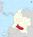
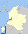
 Colombia - Cauca.svg 2,027 × 2,294; 636 KB


