Category:Maps of counties of Liberia
Jump to navigation
Jump to search
Subcategories
This category has the following 2 subcategories, out of 2 total.
Media in category "Maps of counties of Liberia"
The following 37 files are in this category, out of 37 total.
-
 Bomi-Klay.png 276 × 233; 13 KB
-
 Bomi-Mecca.png 276 × 233; 13 KB
-
 Gbarpolu-Belleh.png 250 × 220; 15 KB
-
 Gbarpolu-Bokomu.png 250 × 220; 15 KB
-
 Gbarpolu-Bopolu.png 250 × 220; 15 KB
-
 Gbarpolu-Gbarma.png 250 × 220; 15 KB
-
 Gbarpolu-Kongba.png 250 × 220; 15 KB
-
 Grand Bassa-District 1.png 306 × 263; 19 KB
-
 Grand Bassa-District 2.png 306 × 263; 19 KB
-
 Grand Bassa-District 3.png 306 × 263; 19 KB
-
 Grand Bassa-District 4.png 306 × 263; 19 KB
-
 Grand Cape Mount-Commonwealth.png 243 × 233; 13 KB
-
 Grand Cape Mount-Garwula.png 243 × 233; 13 KB
-
 Grand Cape Mount-Gola Konneh.png 243 × 233; 13 KB
-
 Grand Cape Mount-Porkpa.png 243 × 233; 13 KB
-
 Grand Cape Mount-Tewor.png 243 × 233; 13 KB
-
 Grand Gedeh-Gbarzon.png 329 × 192; 16 KB
-
 Grand Gedeh-Konobo.png 329 × 192; 16 KB
-
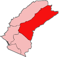
 Grand Gedeh-Tchien.png 329 × 192; 16 KB
-
 Grand Kru-Buah.png 266 × 232; 12 KB
-
 Grand Kru-Lower Kru Coast.png 266 × 232; 12 KB
-
 Grand Kru-Sasstown.png 266 × 232; 12 KB
-
 Grand Kru-Upper Kru Coast.png 266 × 232; 12 KB
-
 Liberia Base Map.png 1,108 × 697; 309 KB
-
 Liberia counties numbered.png 400 × 409; 12 KB
-
 Liberia Counties.png 408 × 418; 10 KB
-
 Lofa-Foya.png 239 × 258; 16 KB
-
 Lofa-Kolahun.png 239 × 258; 17 KB
-
 Lofa-Salayea.png 239 × 258; 17 KB
-
 Lofa-Voinjama.png 239 × 258; 17 KB
-
 Lofa-Zorzor.png 239 × 258; 17 KB
-
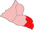
 Margibi-Firestone.png 321 × 228; 10 KB
-
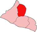
 Margibi-Gibi.png 321 × 228; 11 KB
-
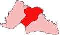
 Margibi-Kakata.png 321 × 228; 10 KB
-
 Margibi-Mambah Kaba.png 321 × 228; 10 KB
-
 Maryland-Barrobo.png 218 × 313; 12 KB
-
 Maryland-Pleebo Sodeken.png 218 × 313; 12 KB


