Category:Maps of counties in Ontario
Jump to navigation
Jump to search
Subcategories
This category has the following 9 subcategories, out of 9 total.
B
E
G
M
R
Media in category "Maps of counties in Ontario"
The following 44 files are in this category, out of 44 total.
-
Brant locator map 2021.svg 349 × 260; 1.77 MB
-
Bruce locator map 2021.svg 237 × 571; 2.34 MB
-
Chatham-Kent locator map 2021.svg 333 × 326; 1.33 MB
-
Dufferin locator map 2021.svg 256 × 384; 922 KB
-
Durham locator map 2021.svg 322 × 362; 4.78 MB
-
Elgin locator map 2021.svg 434 × 242; 1.77 MB
-
Essex locator map 2021.svg 293 × 373; 1.56 MB
-
Esxpel.PNG 239 × 289; 4 KB
-
Frontenac locator map 2021.svg 301 × 445; 7.31 MB
-
Greater Sudbury locator map 2021.svg 337 × 365; 4.16 MB
-
Grey locator map 2021.svg 302 × 409; 2.02 MB
-
Haldimand locator map 2021.svg 379 × 248; 1.33 MB
-
Haliburton locator map 2021.svg 335 × 368; 3.48 MB
-
Halton locator map 2021.svg 289 × 331; 4.11 MB
-
Hamilton locator map 2021.svg 323 × 299; 3.18 MB
-
Hastings locator map 2021.svg 288 × 496; 7.11 MB
-
Huron locator map 2021.svg 296 × 401; 1.66 MB
-
Kawartha Lakes locator map 2021.svg 273 × 445; 3.47 MB
-
Lambton locator map 2021.svg 315 × 386; 2.27 MB
-
Lanark locator map 2021.svg 335 × 351; 4.66 MB
-
Leeds and Grenville locator map 2021.svg 354 × 358; 6.03 MB
-
Lennox and Addington locator map 2021.svg 273 × 484; 5.84 MB
-
Lincolncountyontario.PNG 473 × 329; 10 KB
-
Manitoulin locator map 2021.svg 500 × 263; 3.04 MB
-
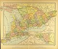
Map of Ontario.jpg 3,480 × 2,920; 2.73 MB
-
Middlesex locator map 2021.svg 340 × 340; 2.55 MB
-
Muskoka locator map 2021.svg 384 × 327; 6.8 MB
-
Niagara locator map 2021.svg 378 × 267; 2.45 MB
-
Norfolk locator map 2021.svg 326 × 313; 1.29 MB
-
Northumberland locator map 2021.svg 356 × 302; 2.81 MB
-
Ottawa locator map 2021.svg 391 × 293; 4.33 MB
-
Oxford locator map 2021.svg 316 × 328; 2.1 MB
-
Parry Sound locator map 2021.svg 404 × 365; 10.89 MB
-
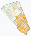
Peel locator map 2021.svg 295 × 341; 4.47 MB
-
Perth locator map 2021.svg 297 × 368; 1.53 MB
-
Peterborough locator map 2021.svg 312 × 391; 4.1 MB
-
Prescott and Russell locator map 2021.svg 406 × 264; 2.17 MB
-
Prince Edward locator map 2021.svg 446 × 218; 1.94 MB
-
Simcoe locator map 2021.svg 343 × 386; 6.14 MB
-
Stormont, Dundas and Glengarry locator map 2021.svg 389 × 316; 4.04 MB
-
Toronto locator map 2021.svg 338 × 250; 5.22 MB
-
Waterloo locator map 2021.svg 337 × 290; 2.56 MB
-
Wellington locator map 2021.svg 364 × 317; 3.51 MB
-
York locator map 2021.svg 264 × 415; 5.48 MB


