Category:Maps of continental shelves
Jump to navigation
Jump to search
Media in category "Maps of continental shelves"
The following 15 files are in this category, out of 15 total.
-
 Antarctic Chile, its territorial waters and surrounding continental shelves.PNG 690 × 1,021; 466 KB
-
 Arctida1.png 1,243 × 621; 144 KB
-
 Batimetriezh ar Mor Keltiek ha Pleg-mor Gwaskogn.svg 3,478 × 3,804; 4.92 MB
-

-
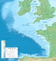
 Celtic Sea and Bay of Biscay bathymetric map-en.svg 3,479 × 3,805; 4.93 MB
-
 Celtic Sea and Bay of Biscay bathymetric map-es.svg 3,478 × 3,804; 4.92 MB
-
 Celtic Sea and Bay of Biscay bathymetric map-fr.svg 3,478 × 3,804; 4.93 MB
-
 Continental shelves.png 1,488 × 714; 48 KB
-

-
 Itsaso Zeltikoko eta Bizkaiko Golkoko mapa batimetrikoa.svg 3,479 × 3,805; 4.93 MB
-
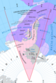
 North Sea Continental Shelf Cases.svg 988 × 1,159; 601 KB
-
 Outer Continental Shelf map.png 898 × 502; 60 KB
-
 Southeastern United States continental shelf.jpg 462 × 374; 41 KB
-
 Western continental shelves of Australia.png 1,034 × 1,483; 89 KB
-
 Zealandia EEZs.tif 2,060 × 2,740; 6.21 MB


_(20219726069).jpg)


