Category:Maps of constituencies of Antigua and Barbuda
Jump to navigation
Jump to search
Countries of North America: Antigua and Barbuda · Belize
Media in category "Maps of constituencies of Antigua and Barbuda"
The following 19 files are in this category, out of 19 total.
-
 Antigua and Barbuda - All Saints East & St. Luke Constituency.svg 512 × 487; 69 KB
-
 Antigua and Barbuda - All Saints West Constituency.svg 376 × 356; 141 KB
-
 Antigua and Barbuda - Barbuda Constituency.svg 376 × 356; 141 KB
-
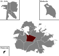
 Antigua and Barbuda - St. George Constituency.svg 376 × 356; 141 KB
-
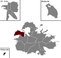
 Antigua and Barbuda - St. John's City East Constituency.svg 376 × 356; 141 KB
-
 Antigua and Barbuda - St. John's City South Constituency.svg 376 × 356; 141 KB
-
 Antigua and Barbuda - St. John's City West Constituency.svg 376 × 356; 141 KB
-
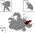
 Antigua and Barbuda - St. John's Rural East Constituency.svg 376 × 356; 141 KB
-
 Antigua and Barbuda - St. John's Rural North Constituency.svg 376 × 356; 141 KB
-
 Antigua and Barbuda - St. John's Rural South Constituency.svg 376 × 356; 141 KB
-
 Antigua and Barbuda - St. John's Rural West Constituency.svg 376 × 356; 141 KB
-
 Antigua and Barbuda - St. Mary's North Constituency.svg 376 × 356; 141 KB
-
 Antigua and Barbuda - St. Mary's South Constituency.svg 376 × 356; 141 KB
-
 Antigua and Barbuda - St. Paul Constituency.svg 376 × 356; 141 KB
-
 Antigua and Barbuda - St. Peter Constituency.svg 376 × 356; 141 KB
-
 Antigua and Barbuda - St. Philip North Constituency.svg 376 × 356; 141 KB
-
 Antigua and Barbuda - St. Philip South Constituency.svg 376 × 356; 141 KB
-
 Parliamentary constituencies of Antigua and Barbuda (1971-1980).svg 376 × 450; 322 KB
-
 Parliamentary constituencies of Antigua and Barbuda.svg 376 × 450; 335 KB


.svg)
