Category:Maps of communes in Côtes-d'Armor
Jump to navigation
Jump to search
Departments of Metropolitan France: Ain [01] · Aisne [02] · Allier [03] · Alpes-de-Haute-Provence [04] · Hautes-Alpes [05] · Alpes-Maritimes [06] · Ardèche [07] · Ardennes [08] · Ariège [09] · Aube [10] · Aude [11] · Aveyron [12] · Bouches-du-Rhône [13] · Calvados [14] · Cantal [15] · Charente [16] · Charente-Maritime [17] · Cher [18] · Corrèze [19] · Corse-du-Sud [2A]† · Haute-Corse [2B]† · Côte-d’Or [21] · Côtes-d'Armor [22] · Creuse [23] · Dordogne [24] · Doubs [25] · Drôme [26] · Eure [27] · Eure-et-Loir [28] · Finistère [29] · Gard [30] · Haute-Garonne [31] · Gers [32] · Gironde [33] · Hérault [34] · Ille-et-Vilaine [35] · Indre [36] · Indre-et-Loire [37] · Isère [38] · Jura [39] · Landes [40] · Loir-et-Cher [41] · Loire [42] · Haute-Loire [43] · Loire-Atlantique [44] · Loiret [45] · Lot [46] · Lot-et-Garonne [47] · Lozère [48] · Maine-et-Loire [49] · Manche [50] · Marne [51] · Haute-Marne [52] · Mayenne [53] · Meurthe-et-Moselle [54] · Meuse [55] · Morbihan [56] · Moselle [57] · Nièvre [58] · Nord [59] · Oise [60] · Orne [61] · Pas-de-Calais [62] · Puy-de-Dôme [63] · Pyrénées-Atlantiques [64] · Hautes-Pyrénées [65] · Pyrénées-Orientales [66] · Bas-Rhin [67] · Haut-Rhin [68] · departmental district of the Rhône [69] · Rhône [69D]‡ · Metropolis of Lyon [69M]‡ · Haute-Saône [70] · Saône-et-Loire [71] · Sarthe [72] · Savoie [73] · Haute-Savoie [74] · Paris [75] · Seine-Maritime [76] · Seine-et-Marne [77] · Yvelines [78] · Deux-Sèvres [79] · Somme [80] · Tarn [81] · Tarn-et-Garonne [82] · Var [83] · Vaucluse [84] · Vendée [85] · Vienne [86] · Haute-Vienne [87] · Vosges [88] · Yonne [89] · Territoire de Belfort [90] · Essonne [91] · Hauts-de-Seine [92] · Seine-Saint-Denis [93] · Val-de-Marne [94] · Val-d'Oise [95]
Overseas departments and regions: Guadeloupe [971] · Martinique [972] · French Guiana [973] · Réunion [974] · Mayotte [976]
Sui generis territories: New Caledonia [988]
Overseas departments and regions: Guadeloupe [971] · Martinique [972] · French Guiana [973] · Réunion [974] · Mayotte [976]
Sui generis territories: New Caledonia [988]

Subcategories
This category has the following 200 subcategories, out of 358 total.
(previous page) (next page)*
2
A
- Maps of Allineuc (4 F)
- Maps of Aucaleuc (4 F)
B
- Maps of Beaussais-sur-Mer (3 F)
- Maps of Belle-Isle-en-Terre (5 F)
- Maps of Berhet (5 F)
- Maps of Bobital (4 F)
- Maps of Le Bodéo (3 F)
- Maps of le Bodéo (2 F)
- Maps of Bon Repos sur Blavet (3 F)
- Maps of Boqueho (4 F)
- Maps of La Bouillie (4 F)
- Maps of Bourbriac (5 F)
- Maps of Bourseul (4 F)
- Maps of Bréhand (5 F)
- Maps of Brélidy (4 F)
- Maps of Bringolo (5 F)
- Maps of Broons (6 F)
- Maps of Brusvily (7 F)
- Maps of Bulat-Pestivien (4 F)
- Maps of Bégard (5 F)
C
- Maps of Calanhel (5 F)
- Maps of Callac (5 F)
- Maps of Calorguen (4 F)
- Maps of Le Cambout (5 F)
- Maps of Camlez (4 F)
- Maps of Canihuel (7 F)
- Maps of Caouënnec-Lanvézéac (4 F)
- Maps of Carnoët (4 F)
- Maps of Caulnes (4 F)
- Maps of Les Champs-Géraux (4 F)
- Maps of La Chèze (5 F)
- Maps of Coadout (4 F)
- Maps of Coatascorn (4 F)
- Maps of Coatréven (4 F)
- Maps of Coëtlogon (4 F)
- Maps of Coëtmieux (4 F)
- Maps of Cohiniac (4 F)
- Maps of Corlay (4 F)
- Maps of Corseul (4 F)
- Maps of Créhen (4 F)
D
- Maps of Dinan (31 F)
- Maps of Duault (5 F)
E
- Maps of Éréac (4 F)
- Maps of Erquy (4 F)
- Maps of Évran (4 F)
F
- Maps of Le Fœil (4 F)
- Maps of Fréhel (2 F)
G
- Maps of Gausson (4 F)
- Maps of Glomel (8 F)
- Maps of Gomené (4 F)
- Maps of Gommenec'h (4 F)
- Maps of Gouarec (4 F)
- Maps of Goudelin (5 F)
- Maps of Grâce-Uzel (4 F)
- Maps of Guenroc (4 F)
- Maps of Guerlédan (1 F)
- Maps of Guingamp (7 F)
- Maps of Guitté (4 F)
- Maps of Gurunhuel (5 F)
H
- Maps of La Harmoye (4 F)
- Maps of Le Haut-Corlay (4 F)
- Maps of Hémonstoir (5 F)
- Maps of Hénanbihen (4 F)
- Maps of Hénansal (4 F)
- Maps of Hénon (4 F)
- Maps of Hillion (4 F)
- Maps of Le Hinglé (7 F)
I
- Maps of Illifaut (4 F)
J
- Maps of Jugon-les-Lacs (9 F)
K
- Maps of Kerbors (4 F)
- Maps of Kerfot (4 F)
- Maps of Kergrist-Moëlou (4 F)
- Maps of Kerien (4 F)
- Maps of Kermaria-Sulard (4 F)
- Maps of Kermoroc'h (4 F)
- Maps of Kerpert (4 F)
L
- Maps of Lamballe (4 F)
- Maps of Lamballe-Armor (3 F)
- Maps of Lancieux (6 F)
- Maps of Landebaëron (4 F)
- Maps of Landébia (4 F)
- Maps of La Landec (4 F)
- Maps of Landéhen (4 F)
- Maps of Lanfains (4 F)
- Maps of Langoat (4 F)
- Maps of Langrolay-sur-Rance (4 F)
- Maps of Languédias (4 F)
- Maps of Languenan (4 F)
- Maps of Langueux (4 F)
- Maps of Lanleff (4 F)
- Maps of Lanloup (4 F)
- Maps of Lanmérin (4 F)
- Maps of Lanmodez (4 F)
- Maps of Lannebert (4 F)
- Maps of Lanrelas (4 F)
- Maps of Lanrivain (4 F)
- Maps of Lanrodec (4 F)
- Maps of Lantic (4 F)
- Maps of Lanvallay (4 F)
- Maps of Lanvellec (4 F)
- Maps of Lanvollon (4 F)
- Maps of Laurenan (4 F)
- Maps of Lescouët-Gouarec (5 F)
- Maps of Le Leslay (7 F)
- Maps of Lézardrieux (3 F)
- Maps of Loc-Envel (5 F)
- Maps of Locarn (4 F)
- Maps of Loguivy-Plougras (5 F)
- Maps of Lohuec (5 F)
- Maps of Loscouët-sur-Meu (4 F)
- Maps of Louannec (4 F)
- Maps of Louargat (4 F)
- Maps of Loudéac (7 F)
M
- Maps of Maël-Pestivien (7 F)
- Maps of Maël-Carhaix (4 F)
- Maps of Magoar (4 F)
- Maps of La Malhoure (4 F)
- Maps of Mantallot (4 F)
- Maps of La Méaugon (4 F)
- Maps of Mégrit (4 F)
- Maps of Mellionnec (5 F)
- Maps of Le Mené (1 F)
- Maps of Merdrignac (4 F)
- Maps of Mérillac (4 F)
- Maps of Merléac (4 F)
- Maps of Le Merzer (4 F)
- Maps of Minihy-Tréguier (4 F)
- Maps of Moustéru (5 F)
N
P
- Maps of Pabu (4 F)
- Maps of Paimpol (5 F)
- Maps of Paule (2 F)
- Maps of Pédernec (4 F)
- Maps of Penguily (4 F)
- Maps of Penvénan (4 F)
- Maps of Perros-Guirec (7 F)
- Maps of Peumerit-Quintin (4 F)
- Maps of Plaine-Haute (4 F)
- Maps of Plaintel (4 F)
- Maps of Plancoët (4 F)
- Maps of Pléboulle (4 F)
- Maps of Plédéliac (4 F)
- Maps of Plédran (4 F)
- Maps of Pléguien (4 F)
- Maps of Pléhédel (4 F)
- Maps of Plélan-le-Petit (4 F)
- Maps of Plélauff (4 F)
- Maps of Plélo (4 F)
- Maps of Plémet (3 F)
- Maps of Plémy (4 F)
- Maps of Plénée-Jugon (4 F)
- Maps of Pléneuf-Val-André (4 F)
- Maps of Plérin (5 F)
- Maps of Plerneuf (4 F)
- Maps of Plésidy (4 F)
- Maps of Pleslin-Trigavou (4 F)
- Maps of Plestan (4 F)
- Maps of Plestin-les-Grèves (4 F)
- Maps of Pleubian (4 F)
- Maps of Pleudaniel (4 F)
- Maps of Pleudihen-sur-Rance (4 F)
- Maps of Pleumeur-Bodou (4 F)
- Maps of Pleumeur-Gautier (4 F)
- Maps of Pléven (4 F)
- Maps of Plévenon (6 F)
- Maps of Plévin (7 F)
- Maps of Plœuc-L'Hermitage (3 F)
- Maps of Ploëzal (4 F)
- Maps of Plorec-sur-Arguenon (4 F)
- Maps of Plouaret (4 F)
- Maps of Plouasne (4 F)
- Maps of Ploubazlanec (4 F)
- Maps of Ploubezre (4 F)
- Maps of Plouëc-du-Trieux (4 F)
- Maps of Plouër-sur-Rance (4 F)
- Maps of Plouézec (4 F)
- Maps of Ploufragan (4 F)
Media in category "Maps of communes in Côtes-d'Armor"
The following 10 files are in this category, out of 10 total.
-
 200707 Binic 13.JPG 2,288 × 1,712; 735 KB
-
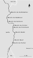
 Carte de Plougrescant.png 3,507 × 4,960; 320 KB
-
 Cotes d'Armor - carte des communes.jpg 5,709 × 4,331; 3.3 MB
-
 La Méaugon - Carte de la commune 01.jpg 4,160 × 3,120; 6.34 MB
-
 Manoir des Fossés - superposition.jpg 1,108 × 990; 88 KB
-
 Omaha Beach 2008 PD 19.JPG 2,272 × 1,704; 844 KB
-
 Perros-Guirec 2008 PD 09.JPG 1,704 × 2,272; 215 KB
-
 Plan du dolmen-chapelle des Sept-Saints.jpg 625 × 358; 71 KB
-
 Pommerit-le-vicomte-moulins-trieux-fr.svg 400 × 700; 24 KB
-
 Île de Pors Scaff.svg 448 × 921; 328 KB


