Category:Maps of commune units of Bielsko-Biała
Jump to navigation
Jump to search
Media in category "Maps of commune units of Bielsko-Biała"
The following 21 files are in this category, out of 21 total.
-
 Biala1890-1925-2002.png 2,112 × 3,597; 7.98 MB
-
 BialaExpansion1564-2002.gif 2,112 × 3,597; 18.99 MB
-
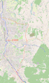
 Bielsko-Biała, granice rad osiedli - commune units location map.png 2,273 × 2,840; 375 KB
-
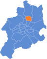
 Bielsko-Biała, Hałcnów (osiedle) 01.png 2,273 × 2,840; 368 KB
-
 Bielsko-Biała, Leszczyny.png 2,273 × 2,840; 372 KB
-
 Bielsko-Biała, Lipnik (obręb i osiedle).png 5,050 × 3,132; 618 KB
-
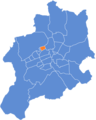
 Bielsko-Biała, Lipnik (osiedle).png 2,273 × 2,840; 370 KB
-
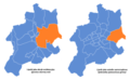
 Bielsko-Biała, Obszary.png 2,273 × 2,840; 373 KB
-
 Bielsko-Biała, Osiedle Beskidzkie.png 2,273 × 2,840; 374 KB
-
 Bielsko-Biała, Osiedle Grunwaldzkie.png 2,273 × 2,840; 373 KB
-
 Bielsko-Biała, Osiedle Karpackie.png 2,273 × 2,840; 374 KB
-
 Bielsko-Biała, Osiedle Kopernika.png 2,273 × 2,840; 374 KB
-
 Bielsko-Biała, Osiedle Mieszka I.png 2,273 × 2,840; 374 KB
-
 Bielsko-Biała, Osiedle Piastowskie.png 2,273 × 2,840; 374 KB
-
 Bielsko-Biała, Osiedle Polskich Skrzydeł.png 2,273 × 2,840; 374 KB
-
 Bielsko-Biała, Osiedle Wojska Polskiego.png 2,273 × 2,840; 374 KB
-
 Bielsko-Biała, podział administracyjny 2.png 2,500 × 3,000; 460 KB
-
 Bielsko-Biała, Stare Bielsko (osiedle).png 2,273 × 2,840; 370 KB
-
 Bielsko-Biała, Straconka (osiedle).png 2,273 × 2,840; 371 KB
-
 Bielsko-Biała, Wapienica (osiedle).png 2,273 × 2,840; 363 KB
-
 Bielsko-Biała, Złote Łany.png 2,273 × 2,840; 373 KB


_01.png)

.png)
.png)


.png)
.png)
.png)
