Category:Maps of cantons of Ille-et-Vilaine to 2018
Jump to navigation
Jump to search
Media in category "Maps of cantons of Ille-et-Vilaine to 2018"
The following 14 files are in this category, out of 14 total.
-
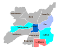
Cantons Rennes 1985.svg 600 × 500; 19 KB
-
Cantons Rennes 2015.svg 600 × 500; 16 KB
-
Cantons Rennes av1973.svg 600 × 500; 12 KB
-
Département Ille-et-Vilaine Arrondissement Kantone 2017.png 2,500 × 2,864; 1.16 MB
-
Département Ille-et-Vilaine Kantone 2017.png 2,500 × 2,864; 1.1 MB
-
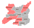
Rennes cantonales 1985.svg 600 × 500; 19 KB
-
Rennes cantonales 1988.svg 600 × 500; 19 KB
-
Rennes cantonales 1992.svg 600 × 500; 19 KB
-
Rennes cantonales 1994.svg 600 × 500; 19 KB
-
Rennes cantonales 1998.svg 600 × 500; 19 KB
-
Rennes cantonales 2001.svg 600 × 500; 19 KB
-
Rennes cantonales 2008.svg 600 × 500; 19 KB
-
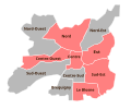
Rennes cantonales 2011.svg 600 × 500; 19 KB
-
Rennes départementales 2015.svg 600 × 500; 27 KB


