Category:Maps of borders of the United Kingdom
Jump to navigation
Jump to search
Subcategories
This category has the following 2 subcategories, out of 2 total.
Media in category "Maps of borders of the United Kingdom"
The following 8 files are in this category, out of 8 total.
-
 Caribbean maritime boundaries map zh.svg 3,561 × 2,221; 2.87 MB
-
 Caribbean maritime boundaries map.svg 3,561 × 2,221; 2.78 MB
-
 Caribbean maritime boundaries map mk.svg 3,561 × 2,221; 5.52 MB
-
 Mapa das Caraíbas (fronteiras marítimas).svg 3,561 × 2,221; 2.86 MB
-
 Mapa del Caribe (límites marinos).svg 5,340 × 3,660; 3.02 MB
-
 Mapa del Mar Caribe (límites marinos)-fr.svg 3,587 × 2,221; 1.91 MB
-
 Mapa del Mar Caribe (límites marinos).svg 3,587 × 2,221; 1.98 MB
-
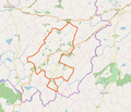 Drummully ED from Openstreetmap 2019.png 904 × 775; 245 KB


.svg)
.svg)
-fr.svg)
.svg)
