Category:Maps of borders of Kuwait
Jump to navigation
Jump to search
Media in category "Maps of borders of Kuwait"
The following 15 files are in this category, out of 15 total.
-
Former Saudi-Kuwaiti Neutral Zone ar.svg 635 × 695; 176 KB
-
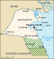
Former Saudi-Kuwaiti Neutral Zone en.svg 595 × 651; 155 KB
-
Former Saudi-Kuwaiti Neutral Zone es.svg 595 × 651; 63 KB
-
Former Saudi-Kuwaiti Neutral Zone mk.svg 595 × 651; 171 KB
-
Former Saudi-Kuwaiti Neutral Zone nl.svg 595 × 651; 167 KB
-
Former saudi-kuwaiti neutral zone.jpg 300 × 300; 100 KB
-
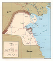
Kuwait and Neutral Zones CIA map 1991.jpg 1,940 × 1,664; 436 KB
-
Kuwait map 1925 IOR R 15 1 733 0035.jpg 5,287 × 4,800; 3.08 MB
-
Kuwait map, 1913.jpg 420 × 406; 63 KB
-
Kuwait Republic 1874 Map.jpg 452 × 565; 67 KB
-
Kuwait's boundaries and other features.png 1,666 × 1,434; 39 KB
-
Kuwait-Iraq barrier-ar.png 1,060 × 1,218; 1.35 MB
-
Kuwait-Iraq barrier.png 1,060 × 1,218; 964 KB
-
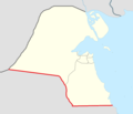
Kuwait–Saudi Arabia border.png 695 × 599; 41 KB
-
Map to show the Limits of Kuwait and Adjacent Country (1913).jpg 3,457 × 3,373; 1.13 MB


