Category:Maps of bantustans in South Africa
Jump to navigation
Jump to search
Subcategories
This category has the following 10 subcategories, out of 10 total.
B
- Maps of Bophuthatswana (9 F)
C
- Maps of Ciskei (5 F)
G
- Maps of Gazankulu (4 F)
K
- Maps of KaNgwane (4 F)
- Maps of KwaNdebele (4 F)
- Maps of KwaZulu (4 F)
L
- Maps of Lebowa (4 F)
Q
- Maps of QwaQwa (4 F)
T
- Maps of the Transkei (12 F)
V
- Maps of Venda (5 F)
Media in category "Maps of bantustans in South Africa"
The following 14 files are in this category, out of 14 total.
-
 1973 Bantustans (30583781200).jpg 1,238 × 1,579; 395 KB
-
 Bantostans sudafricans (annadas 1980).png 822 × 560; 131 KB
-
 Bantustans in South Africa.svg 807 × 711; 240 KB
-
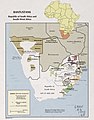
 Bantustans, Republic of South Africa and South-West Africa. LOC 77690312 (cropped).jpg 2,656 × 3,718; 1.21 MB
-
 Bantustans, Republic of South Africa and South-West Africa. LOC 77690312.jpg 3,116 × 4,104; 1.41 MB
-
 Bantustans, Republic of South Africa and South-West Africa. LOC 77690312.tif 3,116 × 4,104; 36.59 MB
-
 Homelands-HE.png 199 × 250; 23 KB
-
 Homelands.png 199 × 250; 22 KB
-

-
 Location of the 100 Battalions in relation to their homelands.png 633 × 743; 63 KB
-
 South Africa & South West Africa Bantustans Map.svg 1,000 × 882; 171 KB
-
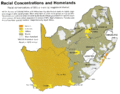
 South Africa racial demographics map 1979.png 940 × 735; 829 KB
-
 South Africa racial map, 1979.gif 940 × 735; 249 KB
-
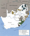 Southafricanhomelandsmap.png 980 × 1,166; 195 KB
.jpg)
.png)

.jpg)


