Category:Maps of bantustans in Namibia
Jump to navigation
Jump to search
Media in category "Maps of bantustans in Namibia"
The following 26 files are in this category, out of 26 total.
-
 1973 Bantustans (30583781200).jpg 1,238 × 1,579; 395 KB
-
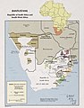
 Bantustans, Republic of South Africa and South-West Africa. LOC 77690312 (cropped).jpg 2,656 × 3,718; 1.21 MB
-
 Bantustans, Republic of South Africa and South-West Africa. LOC 77690312.jpg 3,116 × 4,104; 1.41 MB
-
 Bantustans, Republic of South Africa and South-West Africa. LOC 77690312.tif 3,116 × 4,104; 36.59 MB
-
 LocationBantoustanBushmenland.PNG 250 × 115; 5 KB
-
 LocationBantoustanDamaraland.PNG 250 × 115; 5 KB
-
 LocationBantoustanEastCaprivi.PNG 250 × 115; 5 KB
-
 LocationBantoustanHereroland.PNG 250 × 115; 5 KB
-
 LocationBantoustanKaokoveld.PNG 250 × 115; 5 KB
-
 LocationBantoustanKavangoland.PNG 250 × 115; 5 KB
-
 LocationBantoustanNamaland.PNG 250 × 115; 5 KB
-
 LocationBantoustanOvamboland.PNG 250 × 115; 5 KB
-
 LocationBantoustanRehoboth.PNG 250 × 115; 5 KB
-
 LocationBantoustanTswanaland.PNG 250 × 115; 5 KB
-
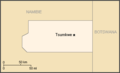
 Map BantoustanEastCaprivi.PNG 403 × 258; 6 KB
-
 MapBantoustanBushmanland.PNG 404 × 247; 3 KB
-
 MapBantoustanDamaraland.PNG 400 × 497; 10 KB
-
 MapBantoustanKaokoland.PNG 445 × 372; 8 KB
-
 MapBantoustanKavangoland.PNG 823 × 356; 10 KB
-
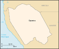
 MapBantoustanOvamboland.PNG 661 × 284; 6 KB
-
 MapBantoustanRehoboth.PNG 283 × 356; 5 KB
-
 MapBantoustanTswanaland.PNG 330 × 287; 4 KB
-
 Namibia homelands 78.jpeg 2,084 × 1,586; 551 KB
-
 Plan Odendaal-fr.png 418 × 418; 19 KB
-
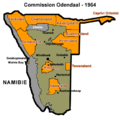
 Plan Odendaal.png 418 × 418; 33 KB
-
 South Africa & South West Africa Bantustans Map.svg 1,000 × 882; 171 KB
.jpg)
.jpg)


