Category:Maps of arrondissements in Gironde (Occitan)
Jump to navigation
Jump to search
Media in category "Maps of arrondissements in Gironde (Occitan)"
The following 19 files are in this category, out of 19 total.
-
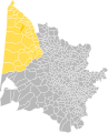
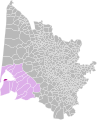 Arrondiment d'Arcaishon.svg 1,000 × 1,234; 674 KB
-
 Arrondiment de Blaia (1800-2006).svg 1,000 × 1,234; 674 KB
-
 Arrondiment de Blaia (2006).svg 1,000 × 1,234; 674 KB
-
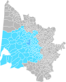 Arrondiment de Bordèu (1800-1926 e 1942-2006).svg 1,000 × 1,234; 676 KB
-
 Arrondiment de Bordèu (1926-1942).svg 1,000 × 1,234; 675 KB
-
 Arrondiment de Bordèu (2006-2007).svg 1,000 × 1,234; 676 KB
-
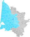
 Arrondiment de Bordèu (2007).svg 1,000 × 1,234; 676 KB
-
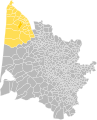 Arrondiment de L'Esparra (1800-1926 e 1942-2006).svg 1,000 × 1,234; 675 KB
-
 Arrondiment de L'Esparra (2006).svg 1,000 × 1,234; 675 KB
-
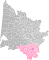
 Arrondiment de La Rèula.svg 1,000 × 1,234; 674 KB
-
 Arrondiment de Lengon (1926-2006).svg 1,000 × 1,234; 675 KB
-
 Arrondiment de Lengon (2006).svg 1,000 × 1,234; 675 KB
-
 Arrondiment de Liborna.svg 1,000 × 1,234; 675 KB
-
 Arrondiment de Vasats.svg 1,000 × 1,234; 674 KB
-
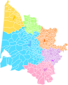 Arrondiments de Gironda (1800-1926).svg 1,000 × 1,234; 669 KB
-
 Arrondiments de Gironda (1926-1942).svg 1,000 × 1,234; 677 KB
-
 Arrondiments de Gironda (1942-2006).svg 1,000 × 1,234; 677 KB
-
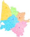 Arrondiments de Gironda (2006-2007).svg 1,000 × 1,234; 677 KB
-
 Arrondiments de Gironda (2007).svg 1,000 × 1,234; 677 KB

.svg)
.svg)
.svg)
.svg)
.svg)
.svg)
.svg)
.svg)

.svg)
.svg)


.svg)
.svg)
.svg)
.svg)
.svg)