Category:Maps of archeological sites in Guatemala
Jump to navigation
Jump to search
Media in category "Maps of archeological sites in Guatemala"
The following 12 files are in this category, out of 12 total.
-
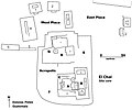
El Chal map of site core.jpg 2,000 × 1,671; 371 KB
-
Guatemala-Peten-around-Flores.png 708 × 506; 40 KB
-
Iximche map.jpg 900 × 626; 229 KB
-
Mapa de complejo de pirámides gemelas.png 731 × 651; 10 KB
-
Mapa de Iximché.jpg 900 × 626; 229 KB
-
Maudslay's 1887 Map of Ixkun, enhanced.png 2,198 × 1,607; 106 KB
-
Maudslays' Map of Ixkun 1899.jpg 4,334 × 2,970; 2.54 MB
-
Mixco Viejo (Jilotepeque Viejo) map.png 1,446 × 1,289; 55 KB
-
Peten Map v3 May archaeological sites.gif 979 × 858; 47 KB
-
Postclassicguatemalahighlands.png 600 × 405; 138 KB
-
San Clemente plan by Karl Sapper 1897.png 2,302 × 4,203; 433 KB
-
Tikal Übersichtskarte.png 2,750 × 1,947; 579 KB


