Category:Maps of archaeological sites in the United States
Jump to navigation
Jump to search
Media in category "Maps of archaeological sites in the United States"
The following 40 files are in this category, out of 40 total.
-
01-Columbia River.jpg 1,367 × 926; 289 KB
-
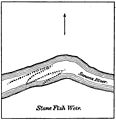
03-Sketch No 1.jpg 1,208 × 1,204; 286 KB
-
04-Sketch No 2.jpg 582 × 848; 282 KB
-
101-FIG 3-map.jpg 1,160 × 1,593; 1.09 MB
-
106 Plan No 1.jpg 882 × 1,726; 986 KB
-
108-FIG 2.jpg 1,087 × 2,122; 1.17 MB
-
122-FIG 1.jpg 1,388 × 2,394; 1.15 MB
-
123-FIG 2.jpg 595 × 342; 132 KB
-
123-FIG 3.jpg 1,610 × 1,313; 493 KB
-
124-FIG 4.jpg 1,402 × 1,323; 923 KB
-
127-FIG 6.jpg 2,072 × 2,151; 868 KB
-
128-FIG 7.jpg 1,095 × 943; 271 KB
-
128-FIG 8.jpg 1,131 × 1,619; 606 KB
-
129-FIG 9.jpg 1,401 × 1,950; 303 KB
-
130-FIG 10.jpg 1,827 × 1,571; 359 KB
-
18-Plan I..jpg 1,253 × 1,529; 1.06 MB
-
21-Plan II.jpg 1,241 × 1,236; 226 KB
-
22-Plan III.jpg 1,659 × 1,118; 524 KB
-
24-Fig 1.jpg 1,187 × 1,768; 1.08 MB
-
25-Fig 2.jpg 617 × 913; 377 KB
-
27-Plat 1.jpg 896 × 917; 240 KB
-
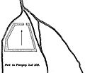
27-Plat 2.jpg 621 × 630; 153 KB
-
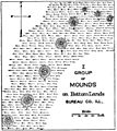
31- I Group of Mounds.jpg 1,441 × 1,622; 1.16 MB
-
33-Fig 1 mound on Spoon river.jpg 1,683 × 1,168; 809 KB
-
36-Fig.2 - mound sections.jpg 1,316 × 1,912; 897 KB
-
55-Section of Shell-Heap.jpg 1,193 × 4,281; 1.17 MB
-
62-mound-areas.jpg 2,087 × 1,481; 1.5 MB
-
64-indian mounds.jpg 1,149 × 977; 162 KB
-
68-map of counties.jpg 1,413 × 2,253; 948 KB
-
76-circular work.jpg 1,146 × 1,571; 234 KB
-
78-counties.jpg 1,293 × 2,126; 1.2 MB
-
80-Site of Three Graves.jpg 1,664 × 1,988; 1.36 MB
-
82-Plan 1.jpg 2,255 × 1,391; 718 KB
-
84-Plan 2.jpg 1,510 × 2,116; 997 KB
-
98- FIG 1-map.jpg 1,693 × 1,370; 508 KB
-
99-FIG.2.-map.jpg 1,628 × 1,620; 778 KB
-
Eastern agricultural complex.png 495 × 500; 901 KB
-
Fremont and Anasazi regions.svg 624 × 769; 73 KB
-
Southern Plains villagers.jpg 1,226 × 1,494; 304 KB
-
Totiakton and vicinity.tif 1,800 × 1,500; 981 KB


