Category:Maps of archaeological sites
Jump to navigation
Jump to search
Subcategories
This category has the following 3 subcategories, out of 3 total.
P
- Maps of Palenque (6 F)
Media in category "Maps of archaeological sites"
The following 31 files are in this category, out of 31 total.
-
13-04-13-st-poelten-domplatz-300.jpg 4,288 × 2,848; 7.16 MB
-
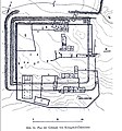
Ad fines kastellplan.jpg 661 × 404; 73 KB
-
Apollonia Apse Building 1958-1959.JPG 1,113 × 591; 82 KB
-
Bulletin (1948) (20238502098).jpg 3,168 × 1,800; 730 KB
-
Early Islamic watercourses and settlements east of the Tigris.png 1,602 × 1,824; 95 KB
-
Plan of Joya de Cerén.jpg 1,031 × 734; 60 KB
-
Gibson - Late Abbasid Map of Kish Area.png 902 × 681; 177 KB
-
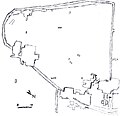
Grabungsplan der keltische Siedlung.jpg 787 × 654; 275 KB
-
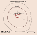
Hatra plan general.svg 730 × 686; 78 KB
-
Hawikuh map.png 584 × 899; 74 KB
-
Juliomagus Plan.JPG 1,944 × 2,592; 919 KB
-
Karte mit dem antiken Stadtplan von Nippur.png 635 × 590; 164 KB
-
Königshof Ödes Kloster.JPG 805 × 865; 392 KB
-
Main Gravettian sites.jpg 831 × 521; 138 KB
-
Map of Augusta Raurica 240 AD - Augusta Raurica - August 2013.JPG 2,950 × 2,090; 2.55 MB
-
Miskolc Archaeological Sites.jpg 1,749 × 874; 242 KB
-
Nippur the inner city (Fisher 1905).jpg 1,448 × 1,164; 808 KB
-
Oberleiserberg ArD-3-139 in A-2115 Ernstbrunn.jpg 2,252 × 2,245; 845 KB
-
P.456-fig.168-Palæolithic Man and Terramara Settlements in Europe.jpg 1,024 × 756; 78 KB
-
Plan of the Glauberg.png 878 × 765; 580 KB
-
ROCEEH Motm 2010 12 Paleolithic Adhesives.pdf 1,752 × 1,239; 205 KB
-
Römische Fundamente Hallau Wunderklingen Grundriss.jpg 5,926 × 2,194; 3.9 MB
-
Shir Lageplan.jpg 232 × 283; 51 KB
-
Sitemap of Dolni Vestonice 1 and 2.jpg 502 × 485; 42 KB
-
Sitemap of Dolni Vestonice 3.jpg 621 × 433; 33 KB
-
Stobi izgled.png 1,520 × 1,212; 262 KB
-
Stobi tlocrt.gif 1,520 × 1,212; 182 KB
-
Susa map.jpg 2,774 × 1,968; 1.11 MB
-
Uyuk Valley, with location of Arzhan 2.jpg 3,326 × 1,748; 989 KB


