Category:Maps of ancient Roman roads in Belgium
Jump to navigation
Jump to search
Media in category "Maps of ancient Roman roads in Belgium"
The following 19 files are in this category, out of 19 total.
-
 Atuatuca.PNG 435 × 497; 257 KB
-
 Bavay - Dinant.svg 600 × 108; 21 KB
-
 Bavay - Gembloux 2.svg 600 × 332; 63 KB
-
 Bavay - Gembloux.svg 600 × 332; 62 KB
-
 Chaussée Brunehault IGN(46 5) 1882.jpg 1,497 × 1,056; 657 KB
-
 Espace gallo-romain de Ath 34.jpg 3,648 × 5,472; 8.98 MB
-
 Espace gallo-romain de Ath 35.jpg 5,472 × 3,648; 8.92 MB
-
 ForHadriani.PNG 435 × 497; 257 KB
-
 Germania inferior roads towns.png 1,162 × 1,134; 1.83 MB
-
 Germanie-inferieure.jpg 1,149 × 1,125; 1.62 MB
-
 Kaart heirwegen elewijt 2.jpg 665 × 246; 49 KB
-
 Roman road Maastricht-Nijmegen (Ferraris).png 1,846 × 428; 1.08 MB
-
 Roman road Maastricht-Nijmegen.png 586 × 173; 193 KB
-
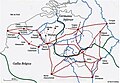
 Roman roads in Belgium.jpg 2,434 × 1,553; 279 KB
-
 Romeinsche oudheden te Maastricht, plaat 1, RP-P-1908-291.jpg 3,716 × 5,706; 2.02 MB
-
 Réseau routier gallo-romain.jpg 1,076 × 748; 441 KB
-
 Tongeren - Gembloux.svg 600 × 300; 71 KB
-
 Tongeren - Herstal.svg 600 × 600; 84 KB
-
 Via Belgica-kaart.png 600 × 223; 15 KB


_1882.jpg)


.png)