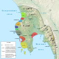
Category:Maps of ancient Pylos
Jump to navigation
Jump to search
Media in category "Maps of ancient Pylos"
The following 9 files are in this category, out of 9 total.
-
Map of ancient Pylos-en.svg 304 × 304; 637 KB
-
Map of ancient Pylos-ru.svg 304 × 304; 580 KB
-
Map of mycenaean Messenia-ru.svg 800 × 800; 1.39 MB
-
Map of the military districts of the Pylos kingdom-ru.svg 800 × 800; 1.41 MB
-
Pulos.png 391 × 581; 237 KB
-
Toponymic map of the Mycenaean Peloponnese.svg 1,243 × 1,559; 1.47 MB
-
UMME Map for Inkscape.svg 772 × 738; 920 KB


