Category:Maps of ancient Luristan
Jump to navigation
Jump to search
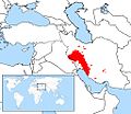
This category assembles maps of the region of Luristan (even if they are not that ancient); in contrast to Category:Maps of Lorestan Province
Media in category "Maps of ancient Luristan"
The following 18 files are in this category, out of 18 total.
-
875 of 'Travels in Luristan and Arabistan. (With plates and maps.)' (11023707044).jpg 1,397 × 3,527; 858 KB
-
Khuzistan languages.jpg 400 × 500; 156 KB
-
Lur peoples map.jpg 512 × 443; 56 KB
-
Lurish Language Map.png 512 × 443; 91 KB
-
Luristan 1875.jpg 972 × 946; 538 KB
-
Luristan in 1720.jpg 828 × 746; 474 KB
-
Luristan in 1875.jpg 801 × 582; 512 KB
-
Luristan in Russo-British Pact in 1907.jpg 803 × 651; 175 KB
-
Luristan Land.jpg 703 × 703; 234 KB
-
Luristan locator map.png 2,000 × 1,028; 301 KB
-
Luristan Region.jpeg 670 × 486; 76 KB
-
Luristan(Laurestan) in 1706-08.jpg 430 × 361; 139 KB
-
Luristan(Laurestan) in 1780-90.jpg 893 × 820; 434 KB
-
Luristan(Louristan) in 1831.jpg 2,065 × 1,700; 853 KB
-
Luristan-1814.jpg 982 × 798; 343 KB
-
Luristan-in-1863, c1860.jpg 760 × 602; 252 KB
-
Map of Lur peoples.png 652 × 600; 65 KB
-
لرستان عراق.jpg 542 × 488; 71 KB


