Category:Maps of ancient Latium
Jump to navigation
Jump to search
Subcategories
This category has the following 4 subcategories, out of 4 total.
Media in category "Maps of ancient Latium"
The following 67 files are in this category, out of 67 total.
-
 Aqua virgo planlatium.jpg 2,734 × 2,099; 2.64 MB
-
 Rom Umgebung.jpg 1,853 × 1,420; 2.65 MB
-
 Römerstraßen rund um Rom (nach Droysen).jpg 1,310 × 1,330; 1.69 MB
-
 Heinrich Kiepert. Italiae pars media.jpg 7,143 × 5,672; 8.42 MB
-
 Butler roma.jpg 3,280 × 1,352; 1.47 MB
-
 Abraham Oertel - Latium - 1595.PNG 1,204 × 942; 3.02 MB
-
 Albe planlatium.jpg 2,734 × 2,099; 1.83 MB
-
 Ancient Latium.png 750 × 502; 1.03 MB
-
 Ardea planlatium.JPG 2,734 × 2,099; 1.83 MB
-

-
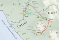
 Aurunci Hernici Latini Marsi Volsci.jpg 1,420 × 930; 241 KB
-
 Carte Capena 400avJC.png 758 × 622; 336 KB
-
 Carte DeuxGuerreSamnite 315avJC Lautalae.png 1,769 × 1,103; 970 KB
-
 Carte DeuxGuerreSamnite 325avJC Imbrinium.png 1,769 × 1,103; 879 KB
-
 Carte DeuxGuerreSamnite 327avJC.png 4,203 × 2,675; 3.26 MB
-
 Carte FinGuerreLatine 338avJC.png 3,039 × 2,448; 2.88 MB
-
 Carte GuerreRomanoAurunce 338avJC.png 2,191 × 1,663; 1.59 MB
-
 Carte GuerreRomanoAurunce 345avJC.png 2,191 × 1,663; 1.33 MB
-
 Carte GuerreRomanoHernique 366avJC.png 2,222 × 1,632; 1.22 MB
-
 Carte GuerresRomanoLatines 380avJC.png 1,371 × 936; 350 KB
-
 Carte GuerresRomanoLatines 389avJC.png 1,849 × 1,527; 1,001 KB
-
 Carte GuerresRomanoVeies 482avJC.png 1,971 × 1,750; 1.1 MB
-
 Carte GuerresRomanoVolsques 358avJC.png 2,222 × 1,632; 1.21 MB
-
 Carte GuerresRomanoVolsques 389avJC.png 2,222 × 1,632; 1.22 MB
-
 Carte OperationsGuerreRomanoEque 389-388avJC.png 1,238 × 876; 454 KB
-
 Carte OperationsGuerreRomanoVolsques 383-381avJC.png 1,238 × 1,103; 460 KB
-
 Carte OperationsGuerreRomanoVolsques 388-385avJC.png 1,238 × 1,420; 604 KB
-
 Carte OperationsGuerreRomanoVolsques 389avJC.png 1,238 × 1,163; 542 KB
-
 Carte PremGuerreSamnite 343avJC.png 3,039 × 2,449; 2.95 MB
-
 Carte TroisGuerreSamnite 298avJC.png 4,203 × 2,675; 3.79 MB
-
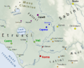
 Central Italian Ancient Peoples.jpg 340 × 340; 20 KB
-
 Crate EnvironsRome Monarchie.png 1,518 × 996; 585 KB
-
 D457-Amphithéâtre Romain.-L2-Ch10.png 1,440 × 1,808; 344 KB
-

-
 Kircher, Athanasius – Latium, 1671 – BEIC 6152674 Lazio Orientale Roma.jpg 1,306 × 1,992; 1.06 MB
-
 Labicum planlatium.jpg 2,734 × 2,099; 1.83 MB
-
 Lacus Buranus bronzo.png 810 × 527; 202 KB
-
 Lago di Bracciano-mappa del 1886.jpg 2,734 × 2,099; 5.58 MB
-
 Late Roman kingdom map-blank.svg 450 × 338; 2.46 MB
-
 Latium -5th Century map-en.svg 900 × 675; 321 KB
-
 Latium -5th Century map-fr.svg 900 × 675; 336 KB
-
 Latium -5th Century map-id.svg 900 × 675; 321 KB
-
 Latium -5th Century map-it.svg 900 × 675; 321 KB
-
 Latium -5th Century map-la.svg 900 × 675; 336 KB
-
 Latium -5th Century map-pt.svg 900 × 675; 336 KB
-
 Latium adiectum blank.png 2,393 × 1,585; 554 KB
-
 Latium et Campania.png 1,158 × 822; 7.38 MB
-
 Latium Mons Algidus 458 BC.png 1,215 × 1,001; 405 KB
-
 Latium vetus blank.png 2,420 × 1,508; 563 KB
-
 Ligue-latine-carte.png 1,215 × 1,001; 298 KB
-

-
 Location of Mons Sacer.JPG 598 × 734; 149 KB
-
 Philipp Clüver - Latium Utriusque.PNG 1,587 × 1,251; 5 MB
-
 PueblosDelLacioYEtruria.svg 644 × 564; 24 KB
-
 Rom Tusculum.jpg 1,853 × 1,420; 761 KB
-
 Roma Antiga - 500 a.C.-es.svg 512 × 441; 63 KB
-
 Roma Antiga - 500 a.C..svg 512 × 441; 26 KB
-
 Roma Antiga-500 a.C.-fr.svg 1,101 × 1,004; 39 KB
-
 Roma em 338 a.C.-es.svg 621 × 648; 66 KB
-
 Roma em 338 a.C..svg 621 × 648; 65 KB
-
 RomanKingdom.png 256 × 196; 10 KB
-
 Rothert, Bd1Bl15 - Die Rechtsentwicklung 510-366.jpg 2,733 × 2,087; 970 KB
-
 Rothert, Bd1Bl16K1 - Erster Samniterkrieg.jpg 2,939 × 1,962; 1.02 MB
-
 Rothert, Bd1Bl16K2 - Zweiter Samniterkrieg.jpg 2,490 × 2,698; 1.2 MB
-
 Rothert, Bd1Bl16K3 - Dritter Samniterkrieg.jpg 2,229 × 2,238; 763 KB
-
 Samnium Frentani Sabina.png 1,187 × 1,103; 12.22 MB
-
 Topographical map of central Itary around Latium.jpg 410 × 537; 96 KB


.jpg)


.jpg)


.jpg)


