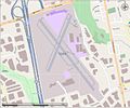
Category:Maps of airports in Ontario
Jump to navigation
Jump to search
Provinces and territories of Canada: Ontario ·
Media in category "Maps of airports in Ontario"
The following 12 files are in this category, out of 12 total.
-
Buttonville Airport Street View.jpg 1,116 × 933; 141 KB
-
Centralia James T Field Memorial Airport.png 1,022 × 672; 173 KB
-
Chatham Kent Airport.png 967 × 673; 99 KB
-
Goderich Municipal airport open street map.png 679 × 581; 82 KB
-
Hamilton Ontario International Airport.png 1,280 × 928; 298 KB
-
Muskoka Airport map.png 1,011 × 933; 238 KB
-
North Bay Airport and CFB North Bay map.png 1,268 × 931; 298 KB
-
St Thomas ON Municipal Airport.png 964 × 669; 115 KB
-
Stratford municipal airport.png 1,024 × 675; 94 KB
-
Thunder Bay Airport.png 941 × 667; 130 KB
-
Victor Mine and airfield in Ontario.png 1,016 × 616; 51 KB
-
Windsor Airport.png 1,252 × 928; 254 KB


