Category:Maps of airports in Germany
Jump to navigation
Jump to search
Subcategories
This category has the following 6 subcategories, out of 6 total.
B
F
M
Media in category "Maps of airports in Germany"
The following 14 files are in this category, out of 14 total.
-
Airliftbases.jpg 538 × 589; 62 KB
-
CTR-EDDK.png 947 × 746; 1.12 MB
-
Ctr-edds.png 939 × 566; 676 KB
-
Dlh36-5.jpg 1,719 × 2,408; 1.69 MB
-
Dortmund airport map.png 2,030 × 486; 450 KB
-
Flughafen und Messe Stuttgart.png 1,225 × 680; 451 KB
-
Frankfurt airport hub map.png 1,158 × 909; 1,004 KB
-
Frankfurt-Main Airport Map DE.png 2,253 × 1,890; 1.53 MB
-
Frankfurt-Main Airport Map EN.png 2,253 × 1,890; 1.52 MB
-
Karte Flughafen.tif 945 × 553; 2.84 MB
-
Kiel Airport - OpenSeaMap.jpg 1,001 × 659; 182 KB
-
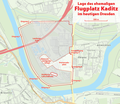
Lageplan Flugplatz Kaditz.png 926 × 801; 481 KB
-
Lange diercke sachsen deutschland verkehr.jpg 2,563 × 1,719; 3.59 MB
-
Map Cologne.png 1,350 × 625; 33 KB


